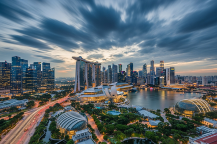
Quick answer: Yes, Seattle is genuinely hilly. The city was built on a series of steep hills between Puget Sound and Lake Washington. While popular areas like Downtown and Queen Anne feature sharp elevation changes, you can easily navigate the city using public transit and strategic route planning to minimize climbing.
Seattle has a reputation for steep streets and challenging walks. When planning a trip to the Emerald City, many travelers worry about the physical toll of exploring. You want to enjoy the sights, but you also want to know exactly what you are walking into.
The short answer is yes, Seattle is one of the hilliest cities in America. However, the terrain is not uniformly difficult. Elevation changes happen quickly, but they are concentrated in specific areas. Understanding the geography will provide reassurance and help you plan a comfortable itinerary.
Knowing what to expect is the best way to travel with confidence. This guide will break down the city’s landscape, highlight the steepest areas, and provide simple strategies to navigate Seattle’s unique geography safely and efficiently.
How Does Seattle’s Elevation Compare to Other Cities?
Why Does Seattle Have So Many Steep Streets?
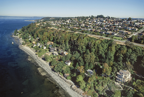
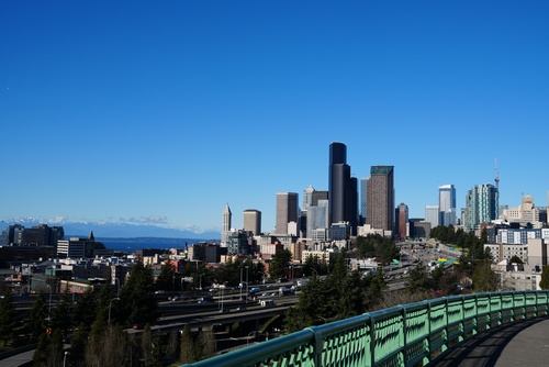
Seattle sits on a narrow strip of land between Puget Sound and Lake Washington. The city was literally built on a series of hills. Elevation changes happen very quickly within short distances. This geographic reality creates the dramatic slopes that catch many first-time visitors off guard.
Is Seattle Hillier Than Portland or Chicago?
Seattle feels significantly hillier than many major US cities. Walking routes often involve sudden, significant elevation changes. Compared to the flat grids of Chicago or New York, Seattle requires more physical exertion. Even Portland, which has its own hills, features a more level downtown core. The steep grades in Seattle are heavily concentrated right where tourists spend the most time.
Which Seattle Neighborhoods Have the Steepest Hills?
While there are many neighborhoods across the Seattle metro area that feature hills, the steepest hills are often referred to as the “seven hills of Seattle”
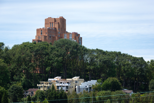
Queen Anne Hill
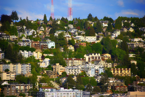
Queen Anne Hill, one of Seattle’s most iconic neighborhoods, stands at a height of approximately 456 feet above sea level, making it the highest named hill in the city. This elevated terrain provides breathtaking views of the surrounding areas, including downtown Seattle, the Space Needle, and Puget Sound. Key streets such as Queen Anne Avenue North and West Galer Street wind through the hill, connecting various parts of the neighborhood while showcasing its charming residential areas and vibrant local businesses. The hill’s steep slopes, particularly along streets like Highland Drive, have become a defining characteristic, offering scenic vistas and a rich historical backdrop. Today, Queen Anne Hill remains a blend of urban convenience and natural beauty, cherished by residents and visitors alike.
Capitol Hill
Capitol Hill is one of Seattle’s most popular and vibrant neighborhoods. While it is technically a hill, the walking experience is generally manageable for most visitors. The incline from downtown is noticeable, but once you reach the main commercial streets like Broadway or Pike/Pine, the terrain levels out significantly.
Beacon Hill
Beacon Hill features a mix of gently sloping and steeper areas, making it moderately challenging for some visitors to walk. The neighborhood is known for its residential charm, expansive green spaces, and stunning views of the city skyline and surrounding mountains. While the climb to the top of the hill may require some effort, the peaceful atmosphere and attractions like Jefferson Park often make the walk worthwhile. With plenty of sidewalks and slower traffic on most streets, it remains an accessible option for those looking to explore at their own pace.
Magnolia Hill
Magnolia Hill offers a unique blend of natural beauty and urban appeal, making it a favorite destination for locals and visitors alike. The hill is adorned with lush greenery, well-maintained trails, and pockets of serene parkland, providing ample opportunities for relaxation and recreation. Its elevated position grants breathtaking panoramic views, perfect for photographers and nature enthusiasts seeking to capture the essence of the city and its surrounding landscape. Despite its tranquility, Magnolia Hill remains conveniently close to shops, cafes, and other amenities, ensuring a comfortable and enjoyable experience for anyone exploring the area.
West Seattle
West Seattle Hill is known for its unique character, including its steep incline and distinct charm. One of the most notable streets on the hill is SW Charlestown Street, which is particularly well-known for its steep gradient. This street, along with others in the area, can be quite daunting for pedestrians and drivers alike, especially during rainy or icy weather. However, the steep streets contribute to the hill’s dramatic views, offering unobstructed vantage points that stretch across the city skyline and beyond. Despite the hill’s challenging slopes, well-maintained sidewalks and roadways ensure accessibility, making it a remarkable destination for those seeking a blend of natural beauty and urban convenience.
First Hill
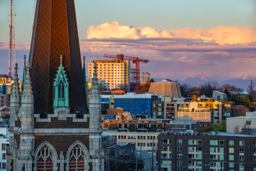
First Hill is one of Seattle’s oldest and most storied neighborhoods. Situated just east of downtown, it rises to an elevation of approximately 300 feet, making it a prominent part of the city’s topography. Madison Street serves as one of the main thoroughfares, connecting the neighborhood to both Capitol Hill and the waterfront area. James Street, with its steep grade, provides a direct but challenging path up the hill, highlighting the area’s dramatic incline. First Hill is home to landmarks such as Harborview Medical Center and the historic St. James Cathedral, further underscoring its importance as both a medical hub and a cultural site. The diverse streets and varied elevation contribute to its dynamic character, offering both bustling urban energy and quiet residential pockets.
Denny Hill
Denny Hill was once one of Seattle’s most prominent geographic landmarks, boasting an elevation that surpassed its current height by over 100 feet. Streets like 5th Avenue, 4th Avenue, and Virginia Street were once steeper and more challenging to traverse before the dramatic regrading projects of the early 20th century significantly reduced the hill’s elevation. At its peak, Denny Hill reached around 240 feet above sea level, creating a towering presence in the city’s landscape. These regrading efforts, aimed at promoting urban development, ultimately transformed the area, leveling the ground and paving the way for the modern-day streets and buildings we see today. Despite its reduced height, the legacy of Denny Hill’s prominent slopes remains a fascinating chapter in Seattle’s history.
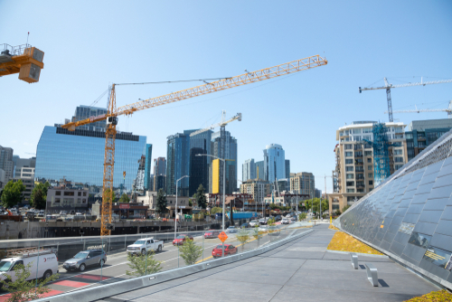
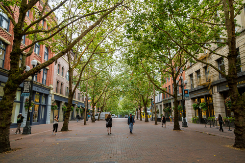
How Hilly is Downtown Seattle?
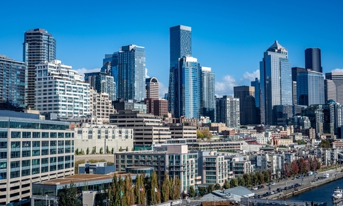
When visiting Downtown Seattle, many tourists are surprised by how exhausting it can be to walk around. Walking east from the waterfront up to the city center involves climbing incredibly steep avenues. A walk of just three or four blocks can feel like a serious workout.
Flatter Areas for Walking in Seattle
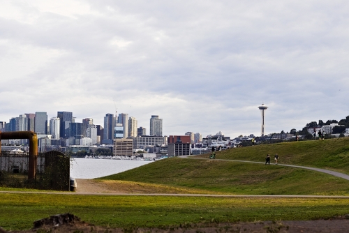
If you want to avoid steep inclines, stick to Belltown and South Lake Union. These areas offer more moderate terrain. Visitors will find a much easier walking experience here, making it simple to visit local restaurants and tech campuses without breaking a sweat. Fremont and Ballard are less dramatic than Seattle’s overall reputation suggests. These northern neighborhoods sit closer to the water level of the ship canal. These are areas where hills are much less likely to affect your daily walking plans. Alternatively walking from the Seattle Center, home of the Space Needle, to nearby neighborhoods like Belltown is mostly flat.
What Are the Steepest Tourist Areas in Seattle?
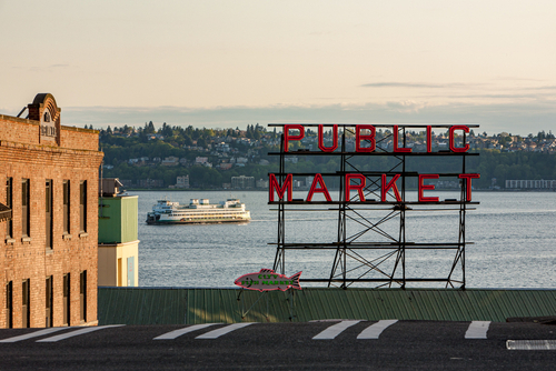
Pike Place Market and theWaterfront
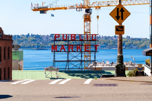
The route from Pike Place Market down to the Seattle Waterfront covers a short distance, but it features a surprisingly steep elevation change. Walking down involves many stairs. Walking back up requires significant effort. According to city accessibility guides, utilizing the public elevators located near the market can save you the climb.
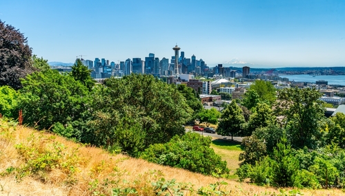
Climbing to Kerry Park in Upper Queen Anne
Kerry Park sits halfway up Queen Anne hill. The amazing views absolutely come with a climb. The effort is worth it for the iconic photo of the Space Needle against Mount Rainier. Choose a ride-share service to reach the park if steep walking is a concern.
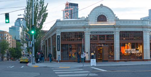
Are There Hills in Pioneer Square?
Pioneer Square, one of Seattle’s historic neighborhoods, has some noticeable hills, especially on foot. While the main historic district is relatively flat, streets like James Street and Cherry Street leading east toward First Hill involve a steep incline. Within Pioneer Square itself, the changes in elevation are generally manageable. However, if mobility is a concern, consider using public transportation like buses or the light rail to avoid these steeper routes. The neighborhood’s iconic architecture and rich history make it worth the effort.
How To Explore Seattle Without Climbing Hills
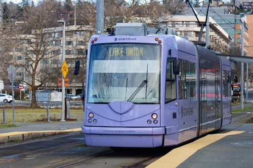
You can absolutely explore Seattle without climbing hills if you plan strategically. The Link light rail provides flat, accessible transportation from the airport through downtown and up to Capitol Hill. Taking standard city buses between different elevations is a highly effective way to save your legs.
The Seattle Streetcar connects South Lake Union to the downtown core, and another line runs through the First Hill neighborhood. Public transportation is highly reliable in Seattle. Use the streetcar when you need to bridge the gap between flat neighborhoods without navigating the slopes in between.
The Perks of Walking Seattle’s Hilly Landscape
Incredible Skyline and Water Views?
Seattle’s skyline and water views are highly memorable specifically because of the elevation. High vantage points provide unobstructed sightlines over Puget Sound and the Olympic Mountains.
Unique Neighborhood Vibes?
Hills naturally separate Seattle into distinct districts. Because of the changing terrain, each neighborhood has its own unique character, micro-culture, and perspective of the city below.
Myths vs. Reality About Seattle’s Geography
Myth 1: Is Every Street in Seattle Incredibly Steep?
Reality: Terrain varies significantly. While the streets running east-to-west in downtown are very steep, the streets running north-to-south are generally flat.
Myth 2: Do You Need to Be Extremely Fit to Visit Seattle?
Reality: Most attractions are fully accessible with smart planning. You do not need to be an athlete to enjoy the city. Using transit and ride-shares makes the city open to everyone.
Myth 3: Will Walking Around Seattle Make You Miserable?
Reality: Many visitors deeply enjoy the city’s walkable neighborhoods. The key is simply knowing which streets to avoid and when to catch a bus.
What Practical Tips Should First-Time Visitors Follow?
To make your trip to Seattle comfortable and stress-free, follow these straightforward tips:
- Wear comfortable, supportive walking shoes. Leave the formal footwear at the hotel.
- Check elevation on Google Maps before committing to long walks. The walking directions will show you the exact incline you will face.
- Use transit strategically to go up hills, even for distances of just a few blocks.
- Allow extra time when walking between attractions.
- Never underestimate the downtown elevation changes between 1st Avenue and 6th Avenue.
Planning Your Seattle Adventure
Yes, Seattle is genuinely hilly. But the city’s reputation is slightly exaggerated because the steepest areas happen to be the most visited. With a little planning, transparency regarding the terrain, and simple transit strategies, the hills become part of the experience. They often lead to Seattle’s best views and most charming neighborhoods. Take your time, use public transportation, and enjoy everything the Emerald City has to offer.
Frequently Asked Questions (FAQs)
What is the steepest street in Seattle?
The steepest paved street in Seattle is East Roy Street between 25th and 26th Avenues East in the Madison Valley neighborhood, featuring a grade of roughly 26%. However, tourists rarely visit this specific residential area.
How much does it cost to use public transit to avoid hills?
The adult fare for King County Metro buses and the Link light rail is a flat rate of $2.75 per ride. Purchasing an ORCA transit card allows for seamless transfers between buses, light rail, and streetcars within a two-hour window, making it highly affordable to skip steep walks.
Can I walk from the Space Needle to Pike Place Market?
Yes, you can walk between these two iconic landmarks. The walk takes about 20 to 25 minutes. The route is mostly flat as you travel through Belltown, making it one of the easiest tourist walks in the city.
Are Seattle sidewalks safe to walk on when it rains?
Seattle sidewalks can become slick during the city’s frequent rain showers, especially on steep grades. Wear shoes with highly textured rubber soles to maintain traction, and use handrails where available on public staircases.
This publication is provided for general information purposes only and is not intended to cover all aspects of the topics discussed herein. This publication is not a substitute for seeking advice from an applicable specialist or professional. The content in this publication does not constitute legal, tax, or other professional advice from Remitly or any of its affiliates and should not be relied upon as such. While we strive to keep our posts up to date and accurate, we cannot represent, warrant or otherwise guarantee that the content is accurate, complete or up to date.