English (US) – Page 25

What’s the Climate Like in Italy?

Discover the diverse weather in Italy throughout the year. Our blog explores regional climates and tips for the best times to visit this beautiful country.

English (US)

Key Highlights

  • Much of Italy has a Mediterranean climate. There are mild winters and hot, dry summers here.

  • The country is long in shape. So, the weather is different in each area. Northern Italy is colder and gets more snow in winter. Southern Italy is warmer in winter.

  • Average temperatures change a lot based on where you are and the time of year. The north gets cool winters. In the south, you will find very hot summer days.

  • Northern Italy can also have a humid subtropical climate. There will be thunderstorms during the summer there.

  • Southern Italy and the islands are known for hot, dry summers. Winters here are mild and have more rain.

  • Fall and spring are the main rainy times for most of Italy.

Introduction

Are you getting ready for your dream trip to Italy? To have a great time, it’s a good idea to know what the weather will be like in this country. Most of the time, Italy is known for its Mediterranean climate. This means you will often get nice weather while you are there. But, because Italy’s boot shape runs from the Alps to the sea, there are many different types of weather. You can find snow in the mountains and warm sun along the coast. The weather in Italy can be as different as the country’s food and the way people live.

Italy’s Climate Overview

Italy does not have the same weather everywhere. Many people think the country is always sunny, but you will find different weather patterns in each region. In the central and southern parts of Italy, there are mild winters and hot, dry summers, which is typical for this area.

But if you go north, there will be a humid subtropical climate. The summers here get hotter and feel sticky, with thunderstorms common during this time. Winters in the north are colder. Rainfall changes too. Most rain comes in fall and spring months.

Geographic Influences on Weather

Geography shapes the weather in Italy in many ways. The long shape of the country and its many coastal areas let the Mediterranean Sea keep things mild most of the year. This means the temperature in these places does not get too hot or too cold.

The Apennine Mountains run right down the middle of Italy. This mountain range blocks weather, so the side on the east is different from the side on the west. Places higher up in the mountains get colder, and you will see more snowfall there in winter than down in the lower parts.

In north Italy, the Alps and the Dolomites create an alpine setting. These tall mountains get lots of snowfall, especially in winter, and make this area a big spot for skiing. The summers up here are cooler too, unlike the hotter south, which feels the warm air moving in from Africa.

Main Climate Zones Across Italy

You can split Italy into a few main climate zones. The biggest of these is the Mediterranean climate. You will find this in the center as well as in the south of Italy. It gives you hot and dry summers. Winters are mild and a bit wet. Most of the time the average temperatures stay nice during the year.

Northern Italy is different. It has a humid subtropical climate, especially in the Po Valley. Here, summers get hot and wet, and storms with thunder are common. Winters in this part of Italy are cold and often foggy. The average temperatures change a lot from one season to the next.

Italy does have a rainy season. For most places in Italy, you will see the most rain in the fall, in October and November, and again in spring, during April and May. The summer usually is pretty dry, mostly in the south. Winter can get wet too, but you see the heaviest and steadiest rain in the months between summer and winter.

Seasonal Changes in Italy

Italy changes a lot with the weather in each season. In spring and fall, the weather is lovely. You get mild temperatures and the average highs are easy to handle. It is a good time for sightseeing. This is when people like to go out and see more of Italy.

When it is summer, Italy gets much warmer. The heat is strong during hot summers, and in the south, the temperature can go up a lot. In winter, you see a big change. Most of Italy has mild winters, but the north and the mountains have much colder winters. There is often a lot of snowfall in those areas.

Spring – March to May

Spring in Italy is a time when things wake up and start to grow. Flowers open and there are more sunny days. From March to May, the weather in Italy is mostly mild and nice, but it can change fast. Average temperatures slowly get higher, and this is a good time to go outside and do things.

You will need to get ready for some rain. Spring is one of the wetter times of the year. April can have a lot of showers, and sometimes there are thunderstorms too, mostly in the country’s north and center. The number of sunny days gets higher as May comes.

It is smart to pack layers when you go to Italy in the spring. There are warm and sunny afternoons, and you can sit outside at a local piazza. But it can still be cool during the evenings. Spring is a good time to visit because it is not too hot like in the summer.

Summer – June to August

Summer in Italy is all about hot summers and sunshine. From June to August, the weather stays very warm. This is the best time to head to one of the beautiful coastal areas in the country for a beach trip.

There is a lot of humidity in cities like Venice and Milan. The air can feel heavy and make the heat even stronger. In Rome, average highs are about 86°F. At times, the temperature can go over 100°F. During June, it is normal for the average highs in Italy to get to the high 70s or low 80s Fahrenheit.

Rainfall is rare during this time, and most of the country stays dry, especially down south. If you want hot summers and to swim in the Mediterranean Sea when it is at its best, this is a good time to travel to Italy.

Fall – September to November

Fall is a nice time to visit italy. The weather is a bit cooler after summer, which can be a relief. If you go in september, many places in italy still feel warm. You can enjoy the sun, go to the beach, or walk around the city with no trouble.

When it gets to october and november, you will feel it get cooler. There is more rain, and these two months are when it rains the most in italy. You will still see many good, clear days, but it is smart to bring something for the rain, more so if you will be in the north.

In venice, more rain mixed with high water can sometimes cause floods in the lower areas during november. Still, this city looks lovely with the colors during autumn. There are harvest festivals going on, and that gives people a special way to see culture in italy during fall.

Winter – December to February

Winter weather in Italy can look very different depending on where you are. From December to February, the north has colder winters. Places like Milan usually get fog and sometimes snowfall. The Alps and Apennines are covered in snow. This makes them great spots if you want to ski.

In southern Italy, the winters are much milder. Rome and other parts in the middle of the country do not see much snowfall. Daytime is cool but you can still get out and about. Sicily and southern Italy have the warmest winters, but they also get more rain during this time of year.

You will not get to sunbathe, but winter in Italy has some nice perks. If you do not like crowds, this is a good time to go. It’s easy to stop by museums and see important sites at your own pace. Make sure to pack warm clothes though. The nights get chilly, and you will need extra layers in the north.

Regional Weather Patterns

Italy is a country that has different weather patterns in every part. Its long shape means that when you go from north to south, the weather can change a lot. The weather in northern Italy is not the same as you will see in southern Italy. So, when you pack to go, it is important to think about which region you will be in.

Northern Italy gets cold in the winter, with summers that are hot and can feel damp. But in southern Italy, you will get a true Mediterranean feel. There, you have very hot and dry summers, but the winters are mild and come with some rain. Knowing about the north and south will help you get ready for your trip to Italy.

Northern Italy – Alps and Po Valley

Northern Italy is framed by mountains like the Dolomites and contains the vast Po Valley, leading to a humid subtropical climate. Cities like Milan and Venice experience hot, muggy summers with thunderstorms and cold, foggy winters. Snowfall is common in the mountains and occurs a few times each winter in cities like Milan.

The average highs in summer can be quite warm, but the humidity makes it feel more intense. Venice is also known for its “acqua alta” or high water in November and December, when high tides and rain can cause flooding.

This region sees its highest rainfall in the spring. Here’s a look at the average temperatures you might find in Milan, a major northern city:

Season

Average High

Average Low

Summer (Jun-Aug)

86°F

64°F

Fall (Sep-Nov)

68°F

50°F

Winter (Dec-Feb)

46°F

32°F

Spring (Mar-May)

68°F

46°F

Central Italy – Tuscany, Umbria, and Rome

Central Italy has many well-known places, like Tuscany, and cities such as Rome and Florence. The area is known for its Mediterranean climate. This means summers are hot and dry, while winters are mild and usually have more rain. The Apennines mountain range is in the region too, and the higher you go, the cooler it gets.

Summers in Rome feel very warm. The average highs are about 86°F, but a heatwave can make it even hotter. It is great weather to enjoy some gelato and watch the sunset over the city’s old ruins. Snowfall does happen sometimes in Rome, but it does not happen often.

Winters in Italy are cool and a bit wet, but they do not get very cold. So, it is a good time to visit if you do not want to deal with crowds. Spring and fall are the best times because the weather is nice and you can explore the hills of Tuscany or walk around the streets of Florence with good weather.

https://www.italy.it/en

Southern Italy and the Islands – Sicily and Sardinia

Southern Italy and the islands of Sicily and Sardinia lie in the very center of the mediterranean climate. Places like Naples and the beautiful Amalfi Coast are here. This area has long, hot, and very dry summers. Warm air from Africa keeps it nice and warm for most of the year.

Unlike northern italy, which has colder and snowy winters, the south gets mild and wet winters. It does not snow much along the coast, but if you go up high, you will see snow. For example, the top of Mount Etna in Sicily stays snow-covered from October until May.

The sea feels great to swim in and reaches its warmest in August. So, if you want sunshine and beach weather, southern italy is the best place. The summers here are hotter and drier than in any other part of italy.

Weather Tips for Travel Planning

Knowing the climate is key when you plan your Italian adventure. You need to check the average temperatures for where you will go and what time of year you will visit. This will help you pick the best time to go and help you decide what clothes to put in your suitcase. Packing the right things can change your whole trip.

You may want mild weather if you go for city tours. Other people may want hot sun to go to the beach. A bit of research helps everyone. If you bring the right travel basics, you will be comfortable with any weather the Italian sky brings you.

Best Times to Visit Italy for Mild Weather

If you want to visit Italy when the weather is at its best, go during the shoulder seasons. In spring and fall, it is not too hot or too cold.

These are the best times if you love sightseeing or being outside. The average highs during these months feel good on your skin. You will also see lovely scenery, with fresh flowers in spring and deep colors in fall.

To get the best of this mild weather in Italy, plan your trip for:

  • April to June: Late spring has warm, sunny days that are great for walking around. There are also fewer people here than in summer.

  • September to October: Early fall is still bright and warm. The average highs in places like central and southern Italy are low enough to enjoy, with better weather than you get in July and August.

Packing Tips and Travel Essentials

Your packing list for Italy will change a lot depending on the season and where you will go. If you are traveling in hot summers with high humidity, you need to pack clothes that are light and that let your skin breathe. No matter the number of days you will be in italy, you want things that you can wear for more than one thing or use in different ways.

One thing you must pack is comfortable walking shoes. You will walk a lot there! If you plan to visit in spring or fall, you should pack layers like sweaters or a light jacket. It can be warm during the day and get cool later, so it helps to be ready.

Here are a few important items to pack:

  • Sunscreen and a Hat: You need these for the sunny days in spring or summer.

  • A Reusable Water Bottle: Stay cool and drink water often, that is very important with heat and humidity in cities during the summer.

  • An Umbrella or Raincoat: You should pack one in spring and fall, as you may get rain on some days.

  • A Scarf: This is good to have if the night gets cool or for going into churches where you need to cover your shoulders.

Conclusion

To sum up, it’s good to know about the weather in italy before you plan your trip. Every season has something special. Spring has fresh flowers. Summer is warm and bright. In autumn, you see many colors. Winter brings calm and snow. The weather is not the same everywhere. There are big changes from one place to the next. For example, the sun feels warm in rome when you walk outside. Up in the alps, you can ski on white snow.

If you know what to expect and pack well, you will have a good time any month you go. So, if you want to see italy and have a great trip, you can reach out for ideas and helpful advice made just for you.

Key Highlights

  • Metropolitan France has a mild climate, but the weather can be very different depending on the season and where you are.

  • In the west part of France, there is an oceanic climate. Winters are not too cold, but they are damp and have a lot of precipitation.

  • In the south, you will get a Mediterranean climate where summers are hot and winters are mild and dry.

  • If you are in eastern France, you will find a continental climate. Summers are warm and there may be thunderstorms, while winters are cold.

  • High temperatures in the summer, even in the south, do not often go over 35 degrees Celsius (95°F).

  • Always look up the weather forecasts before you go on your trip, so you know what to pack for all types of weather conditions.

Introduction

If you are planning to go to France, it helps to know about the weather and climate. France is a big country in western Europe. It has many types of weather. People often say the climate is mild, but you will see a lot of changes in different parts of France and at different times of the year. This guide will show you what you can expect from the weather in France. The tips here can help you pack the right clothes and plan your trip in the best way, wherever or whenever you go in France.

Understanding France’s Climate and Weather Differences

When you talk about conditions in France, it helps to know the difference between weather and climate. Many people use these words to mean the same thing, but they are not the same. To really get the feel of France, you must know this difference.

You can see big temperature differences and changes in precipitation in different parts of France. Some coasts get a lot of rain. The south gets many sunny days. The climate in each area is what shapes the weather you get every day. Here, we will look at what makes weather and climate different. Then, we will go over the main climate zones in France.

Weather vs. Climate: What’s the Difference in France?

So, what makes weather and climate different in France? When you think about “weather,” it’s about what’s going on in the air right now or coming up soon. The weather is the changes you see each day, like rain, sun, wind, or humidity. These are the things you check on your phone before you leave the house. If it’s sunny in Paris today, that is the weather.

But “climate” is not the same. Climate is about the weather patterns over a long time in one place. It is like looking at the average weather after many years. For example, southern France is known for its hot and dry summers. This is the climate of that area.

So, the climate is what you plan for, and weather is what you face every day. The climate can tell you to take light clothes for your summer visit in Marseille, but you will still need to look at the day’s weather forecast to see if you should also bring an umbrella.

Overview of France’s Main Climate Zones

Metropolitan France has three main climate zones, and each gives you a different experience. First, there is the oceanic climate in the west. This part includes the Atlantic seaboard. Here, you will see that winters are mild and damp. The days often bring precipitation in all seasons. The changes in temperature between one season and the next are not big.

In the east of France, near Germany and Switzerland, you will find a continental climate. This place gets warmer summers, along with thunderstorms sometimes. Winters in this area get cold. The temperature can drop below freezing, and the mountains see snow.

If you go south, the Mediterranean climate is what you get. Here, summers are hot and dry, with high temperatures that many people like for a beach day. In winter, it does not get too cold and there is not much rain. But during autumn, heavy rain can come with thunderstorms. Sometimes, this heavy rain can cause flooding.

Regional Weather Patterns Across France

France is pretty big, and it has many different places when it comes to weather. You can see different weather across western Europe, and that is true in France too. The climate zones here create a mix of weather from the coast to the inland mountains. You will find big temperature differences and lots of changes in rainfall as you move from north to south.

These things make it clear that what you feel in Paris may not be the same as in Marseille, even if it’s the same day. Let’s look at some main areas in France so you can know what to expect when you travel there.

Comparing Paris, the Mediterranean, and Atlantic Regions

The weather you’ll encounter can vary dramatically between France’s major cities. Paris, located inland, has a climate that is a mix of oceanic and continental influences. This means you can expect moderately warm summers and cool, damp winters, with rainfall possible any time of year.

Cities on the Atlantic coast, like Nantes, experience a true oceanic climate. Winters are mild but wet, and summers are pleasant but not overly hot. In contrast, Marseille on the Mediterranean coast enjoys hot, dry summers and mild, drier winters, making it a popular destination for sun-seekers. The autumn season is when the Mediterranean region sees its heaviest rainfall.

To illustrate, here’s a general comparison of weather characteristics in these cities:

City

Region

Typical Summer

Typical Winter

Rainfall

Paris

Inland

Warm, some rain

Cool and damp

Moderate year-round

Nantes

Atlantic

Pleasant, mild

Mild and wet

Frequent year-round

Marseille

Mediterranean

Hot and dry

Mild and dry

Heaviest in autumn

Mountain and Inland Climate Characteristics

When you go farther from the coasts, you see that France’s inland and mountain regions have their own types of weather. Cities like Lyon, Dijon, and Poitiers are not close to the sea. This means the temperatures and seasons here stand out more. In the summer, these places often get warm days. Severe storms and thunderstorms can also happen at this time. The winters are colder than what you feel by the coast.

The mountains, like the Alps and Pyrenees, have what people call a mountain climate. When you go up higher in the mountains, it gets much colder. Winters can be cold and full of snow. This is good news if you like winter sports. But, you should know that the weather can change fast up there. It’s always smart to check for local alerts or weather warnings before you plan a trip or go on a hike.

The continental part of France means the range of temperatures changes a lot. A summer day in Lyon can be very hot. Then in winter, it can go below 0°C (32°F). The change between hot and cold is bigger here than in places near the Atlantic coast.

Conclusion

To sum it up, it’s good to know about the weather in France before you travel. This helps you plan your trip and enjoy it more. The summers are bright and lively in the south near the Mediterranean. The Alps get a lot of snow during winter. Every area has the own special weather and different seasons. If you are walking around the old streets in Paris or relaxing at the sunny beaches in Nice, it helps to know what weather you can expect. This way, you can pack the right things and get the best out of your trip. When you get ready for your visit, think about these tips to have a great time in France. If you want to know more about the weather in France or Paris, you can always ask for more help.

Frequently Asked Questions

How does the weather in Paris differ from other major cities in France?

The weather in Paris is usually softer than in Lyon. But Paris is not as sunny or warm as Marseille. Paris has a bit more clear seasons than Nantes, which is on the Atlantic coast. Also, Paris gets less rain all year than Nantes. Each city shows the kind of weather that is common in its area, like ocean weather, Mediterranean, or what you find far from the sea.

Keywords: paris, precipitation, nantes, lyon, marseille

What should travelers expect for summer weather in France?

From June to September, the weather in France is warm or even hot. In the south, you will see high temperatures and a lot of sun. Places with an oceanic climate are not as hot, but still nice. This is a good time to go to France, but make sure you take light clothes and sunscreen.

How often does it rain in France throughout the year?

Rainfall in France is not the same in every area. The western and ocean sides get rain a lot, but it is often light and happens all through the year. The south part near the Mediterranean is the driest, and it gets most of its rainfall in autumn. If you want to know more about local weather, it is smart to look at precipitation forecasts on AccuWeather before you go on your trip.

Key Highlights

Here are the key things to know about the weather in Germany:

  • The weather in Germany is not the same everywhere. It can be quite different in the Alps compared to the lowlands up north.

  • You can check 7, 10, and 14-day forecasts for places like Berlin and Munich.

  • Summers in Germany are warm, so it is good to visit cities then. Winters get cold, with the south being colder than other places.

  • You can trust forecasts from sources like Accuweather. They help you know what to pack for any season in Germany.

  • There are big differences in weather between regions in Germany. You will see that Berlin and the mountains near Munich can have very different weather.

Introduction

Are you thinking about a trip to germany and not sure what to pack? It is good to know about the weather if you want your visit to go well. germany is a big place. The weather can be different depending on where you are in the country. You might walk the old streets in berlin, hike in the mountains, or want to see the vineyards. When you know what the weather is like, you get to enjoy your time even more. This guide will tell you about germany’s climate and help you understand changes in season or weather in different areas.

Germany’s Climate Overview

Germany has a mild climate for most of the year. The country has clear spring, summer, fall, and winter seasons. The weather in germany comes from both sea and land, so there can be many changes. Summers get warm, but not very hot. In winter, it is often cold and cloudy, but not too harsh. There are not many days with very high or very low temperatures.

The weather can change quickly during the year. In some cities, like munich, you can have sunny and warm days. This can turn into rain and more humidity very fast. Germany is also a big country, from the alps in the south to the North Sea in the north. This is why the weather in different places can be quite different. Now, let’s see how the climate is in other parts of the country and how it changes with each season.

Regional Weather Patterns in Berlin and Beyond

Yes, the weather in Berlin is not the same as in other parts of Germany. The country has different types of weather because the land changes from north to south. There are flat lands up north and big mountains, the Alps, in the south. Because of this, each region can be different. For example, Berlin, the capital, does not have the same weather as Munich, which sits closer to the Alps.

The coastal places up north have winters that are not very cold, but they get more rain and their summers are cooler. When you go farther into the country, you see a change. The weather gets warmer in the summer and colder in the winter. Berlin is in this area, so it gets hot days in summer—good for walking around the city.

In the south, the Alps change the weather a lot. Near Munich and the mountains, the winter can be very cold and snowy. That is why many people come for winter sports. In summer, there is often more rain and changes in humidity in these mountain regions. Because the weather can change from one place to another, it is best to check the weather for the part of Germany, like Berlin or Munich, that you will visit.

Seasonal Changes and What They Mean for Travelers

It is important to know about Germany’s seasons before you plan your trip. The best time to get good weather in germany is usually late spring to early autumn. Most people like to visit from May to September. You can enjoy warm days and long daylight hours during these months. This is great for sightseeing in places to go like berlin and munich.

june, july, and august are the warmest months. You will see the most tourists at this time. If you want nice weather and not too many people, try going in the shoulder months instead.

Here’s a quick look at what each season is like:

  • Spring (March-May): It is mild and feels good outside, but the weather can change fast.

  • Summer (June-August): The days are warm or hot with a lot of sunshine.

  • Autumn (September-November): It gets cooler and you will see lots of fall colors on the trees.

  • Winter (December-February): This time is cold. It is often below freezing and it may snow.

Month-by-Month Weather and Forecast Essentials

To get ready for your trip to germany, you should know what the weather is like each month. The temperature and how much it rains can change a lot throughout the year. This has a big effect on what you will pack and what daily things you can do. If you want to see berlin in the summer or visit a winter market, it is important to look at the forecasts first.

You can find up-to-date forecasts and monthly reports that show you what the weather may be like. These help you understand the average temperatures and rainfall for the time you plan to visit. Use these forecasts before you go so you can be prepared for your germany trip.

Average Temperatures and Rainfall Throughout the Year

Average temperatures in Germany generally range from cold in the winter to pleasantly warm in the summer. Winters can see temperatures drop to around freezing, while summer highs often reach the mid-20s Celsius (70s Fahrenheit). Cities like Berlin and Munich follow this general pattern, though local variations exist.

Summer rainfall can be expected, but it often comes in the form of short showers or thunderstorms rather than continuous downpours. June, for example, may have days with “patchy rain nearby,” but total rainfall can be minimal, allowing for plenty of outdoor activities. Checking short-term forecasts will help you plan around any expected precipitation.

Here is a sample table based on data for a week in June to give you an idea of daily variations:

Date

Condition

High (°C)

Low (°C)

Rainfall (mm)

June 2

Patchy rain nearby

23

10

0

June 3

Patchy rain nearby

17

10

0

June 4

Patchy rain nearby

18

12

0

June 5

Patchy rain nearby

18

9

0

June 6

Patchy rain nearby

20

6

0

Short-Term and Extended Weather Forecasts for Germany

For the best planning, you should check both short and long-range weather forecasts. If you plan to go to Germany, it is good to have updates whether it is for a short city visit or a big holiday. You need to know about the temperature, rain, and wind for your trip. Sites like Accuweather give you details that can help get you ready.

You can usually find many kinds of forecasts to fit what you want. These updates to the forecasts make sure you have the most reliable facts. That way, you can make the most of each day, if you plan to hike, ski, or just explore a new city. Be sure to see if there are any weather alerts too.

Here are the kinds of forecasts you can find:

  • 7-Day Weather Forecast: This is good for short trips, giving you clear details on temperature and rain.

  • 10-Day Weather Forecast: This one is best for longer trips, like hiking or skiing. It can help you know what to pack.

  • 14-Day Extended Weather Forecast: This is a good choice for family holidays. You can plan days around the good weather.

Accuweather will be one of the best sites for germany forecasts.

Conclusion

In the end, knowing the weather in Germany is key for anyone who wants to visit or live there. The weather changes a lot from place to place and during each season. By staying up to date, you can enjoy all the things Germany has for you, no matter what the weather is. You might spend time at bright summer events or go see the winter views. When you know what to expect, it helps you have a better time. Be sure to look at the usual temperatures and how much rain there is before you plan what to do. If you want to have a good time in Germany, look at the weather updates often so you get fresh news and enjoy your trip!

Frequently Asked Questions

When is the best time to visit Germany for pleasant weather?

The best time to enjoy good weather in Germany is from late spring to early autumn. This means from May to September. In June, you can get warm days and lots of sun. This is a good time to see cities like Berlin. You should always check the forecasts before your trip. It can get humid, and there may be short rain even during the summer.

How often does Germany experience extreme weather events?

Extreme weather does not happen often in Germany, but it can still take place. There can be heavy rain that may lead to flooding. Heatwaves can show up during summer. In the winter, a lot of snow can fall, mostly near the Alps. It is good to check accuweather alerts and local forecasts for any news or updates during your time here.

Where can travelers check a live weather map for German cities?

Travelers can look at live weather maps and get detailed forecasts for cities in germany, such as berlin and munich. You can use different weather websites and apps. Good sources like Accuweather give you the latest forecasts, radar maps, and weather alerts. This can help you plan what to do while you are in germany.

Key Highlights

  • Jamaica has a warm and humid climate all year. There are no big changes in temperature.

  • The official hurricane season starts on June 1st and ends on November 30th. The months with the most rain are May and October.

  • Top travel spots like Montego Bay, Ocho Rios, and Negril stay warm most of the time. The temperatures can change a little in each place.

  • Kingston, which is the capital, can get hotter. This is much like Montego Bay and is because Kingston is on the south coast.

  • You need to check the daily weather forecast for your plans. Afternoon showers are common, especially in the rainy season.

  • Even with some rain in the forecast, Jamaica does not get many full days of rain, so you still get lots of sun.

Introduction

Planning to visit a tropical paradise? The Jamaica weather is part of what makes that trip so good. Think about warm sun, soft sea winds, and a lively Caribbean culture. You do not need winter coats for Jamaica. The climate on the island lets you wear light clothes all year. If you know about the sunshine and humidity patterns, you can pack better for your trip. This way, you get to enjoy your time in Jamaica more. Let’s help you get ready for your sunny break.

Weather Patterns and Climate in Jamaica

Jamaica has warm weather, thanks to the tropical air and the Caribbean Sea. The sea keeps the weather calm and helps stop big changes in temperature. You will also notice the North-East Trade Winds. Because of this, the air is cooler at times, mostly in winter. These winds move the air and make the place feel fresh.

You can visit at any time because the warmth stays steady. When it is hotter, you will see that the humidity goes up, but the mountains and trees help the air to stay cooler in some spots. Places like the Blue Mountains are great when you want relief from the heat. Next, we will look at how the weather in Jamaica changes each season and what you will get when you come.

Seasonal Changes and Typical Conditions

Jamaica does not have the four seasons that you may know. Instead, there is a dry season and a wet season. The dry season is from December to April. A lot of people say this is the best time to go because there is less rain and a lot of sunshine.

When June comes, or in other summer months, the weather gets hotter. The days are longer and the Caribbean sun feels much stronger. You will notice the humidity goes up during this time. This can make the air feel thick and warm. Summer is a good time if you want to be at the beach or do things outside, but you need to be ready for the heat.

No matter what time you visit Jamaica, you should pack sunscreen. Use it to keep your skin safe from the hot sun. The weather in Jamaica is usually easy to guess, with warm days and a little cooler at night. Even on the coolest nights, a light sweater will be enough to keep you comfortable.

Impact of Rainy Season and Hurricane Risks

The rainy season in Jamaica happens at the same time as the Atlantic hurricane season. This runs from June 1st to November 30th. Still, the island gets the most rain in May and October. Don’t forget, the rainy season in Jamaica does not mean it rains all the time. Most days, you will get quick heavy showers in the afternoon, and then the sun comes back out.

Some might worry about hurricane season, but the chance of a big storm hitting the island during your stay is low. Jamaica sends out alerts early about any storms. This helps people get ready. It is good to stay on top of forecasts and alerts.

To stay safe with plans during hurricane season in Jamaica:

  • Check weather alerts and forecasts often, both before your trip and while you are there.

  • Plan outdoor things for the morning, because rain happens more in the afternoon.

  • Keep some indoor activities as a backup if you get a rainy day.

Regional Weather Highlights

Jamaica has many different types of land. Because of this, the weather can change a lot in different parts of the island. The mountains in the middle of Jamaica are cooler. These places also get more rain than the beaches. The north coast, where most big resorts are, is usually wetter than the south coast. This happens because the winds hit the mountains on the north side.

There are big changes in weather from place to place. So, if you check the forecasts for where you are going, you will get good weather info. It does not matter if you go to the busy beaches on the north or the old city in the south. Knowing what the weather conditions will be like can help you make the most of your time. Now, let’s look at the usual weather in two of jamaica’s best-known places.

Forecasts and Climate in Montego Bay

Montego Bay, or “Mobay” as it’s affectionately called, is one of Jamaica’s top tourist destinations and is known for having some of the highest temperatures on the island. If you love heat and sunshine, this is the place for you. The weather forecast here is typically sunny, with warm temperatures year-round perfect for hitting the beach.

The hottest month in Montego Bay is July, when temperatures can climb up to 91°F (32°C). Even in its coolest month, January, the average temperature hovers around a pleasant 82°F (27°C). Because of its popularity, you can easily find a detailed 10-day weather forecast online to help you plan your activities, whether it’s swimming, sunbathing, or exploring local attractions.

To give you a clearer picture, here’s a general look at the average monthly temperatures you can expect in Montego Bay.

Month

Average High Temperature (°F/°C)

January-March

82°F / 27°C

April-June

86°F / 30°C

July-September

91°F / 32°C

October-December

84°F / 29°C

Typical Weather in Kingston

Kingston is the capital city on Jamaica’s southern coast. It is a busy place and full of energy. The city stands out for its weather conditions and is also a main spot for administration and business on the island. Kingston, like Montego Bay, can get some of the hottest temperatures in Jamaica.

The highest temperatures happen in July and August. You will see the weather go up to about 91°F (32°C) at this time. Humidity is also high, especially when it is rainy. But because Kingston is in the rain shadow of the Blue Mountains, the city gets less rain than northern parts of Jamaica.

If you want cooler weather, plan to visit between December and March. During these months, temperatures in Kingston drop to around 73°F (22°C) on average. This time is more comfortable for sightseeing, checking out museums, and enjoying all the city has to offer. Jamaica weather in Kingston is good for people who want both a lively city and warm, tropical heat. The weather conditions and humidity make Kingston different from other spots on the island like Montego Bay.

Conclusion

To sum up, knowing about the weather in Jamaica helps you plan your trip in the best way. The sunny days in Montego Bay and the warm air in Kingston make the island a great place to visit. When you know about the different seasons, you can have a better time during your stay. Pay attention to the rainy months and be aware of hurricane risks, so you can pick the best time to go for good weather conditions. Jamaica has amazing places and a rich culture for you to see. Take your time to get ready and make the most out of your visit. If you want weather updates on Jamaica and tips from experts, you can get a free consultation anytime.

Frequently Asked Questions

When is the best time to visit Jamaica for great weather?

The best time to go to Jamaica is in the dry season, from December to April. This is when the weather is really nice. There is not much rain and the humidity is low. You get a lot of sun, which is great for the beaches in Montego Bay, Ocho Rios, and Negril.

How reliable are Jamaica’s daily weather forecasts?

Jamaica’s daily weather forecasts can be counted on for giving you the bigger picture, like how warm it will be and if it will be sunny. But the weather there can change suddenly, and you might get quick afternoon showers. So, check jamaica weather forecasts and alerts every day from trusted places. Be ready for things to change fast, especially when it is the rainy season.

Where can I check the latest weather updates for Jamaica?

You can see the latest Jamaica weather news on big weather sites and phone apps. For the best info that fits Jamaica, visit the Meteorological Service of Jamaica website. These places show jamaica weather forecasts, alerts, and how things look in the caribbean.

Key Highlights

Here are the key takeaways about Cuba’s weather:

  • Cuba has two main seasons. There is a dry spell from November to April. Rain starts in May and goes until October.

  • The hurricane season in Cuba begins in June and ends in November. At this time, there is a higher chance of torrential downpours.

  • The temperature in La Habana stays warm all year. In summer, it feels hotter because of high humidity.

  • It is important to check forecasts when making plans. The weather in Cuba can change fast during the rainy season.

  • Look at the daily UV index. It is often high or extreme, so you will need sun protection.

  • Air quality in Cuba is usually good. However, sensitive groups can get moderate symptoms in some conditions.

Introduction

Are you planning a trip to Cuba? It helps to know about the weather in this wonderful place. This guide gives you all the basics on Cuba’s climate. You will learn what to expect in Havana and in other top spots. We will talk about different seasons, what the temperatures are like, and how the weather changes during the year. You will also get the newest weather news, with tips about humidity and air quality. This will help you pack the right things and really enjoy your time in Cuba.

Understanding Cuba’s Climate Throughout the Year

Cuba has a tropical climate. This means it stays warm throughout the year. The weather is mostly split into two main seasons—a dry spell and a rainy season. Temperatures stay about the same during these times. But, humidity and precipitation change a lot.

In the dry season, you will see a lot of sunshine. There are only small periods of rain, and wind speed is usually low. In the summer months, the air gets more humid, wind speed picks up, and there may be occasional storms. Knowing about these patterns can help you read weather forecasts the right way. You will also be better prepared for your trip. Next, we will talk about the weather in Havana. We will also see how it is different from other places in Cuba.

Weather Patterns in Havana and Across the Island

Weather in Havana, also known as La Habana, is often warm and sunny. There can be some showers in the afternoon, especially in the months when it rains more. Right now, you may see partly sunny weather, and the temperature can be in the mid-80s°F. Because of the humidity, it may actually feel hotter than this.

Havana gives you a good idea about Cuba’s weather, but there can be small changes from one place to another. For example, places inside the island like San Jose de las Lajas might have weather that is not exactly the same as the coast where the capital sits. The visibility is usually very good in Cuba, often more than 12 miles. You can get a clear look at what is around you.

Air quality in Cuba is mostly fair and good for most people. But if you are part of the sensitive groups, you should know that if you are outside a lot during certain weather times, you might feel some minor or moderate symptoms.

Seasonal Variations—Dry and Rainy Seasons Explained

Cuba has two main seasons. The dry spell lasts from November to April. This is the best time to go because there is less humidity, more sun, and it feels nice outside.

The rainy season starts in May and lasts until October. It is more humid in this season, and you will find more periods of rain. It does not rain all day, but there are often short, heavy showers and sometimes a heavy thunderstorm in the afternoon. Over the next 10 days, you may see some rain almost every day.

Key points about the rainy season are below:

  • Torrential Downpours: The rainy season brings these, and they may cause a flash flood risk in some places.

  • Increased Precipitation: You will see a lot more rainfall each month during this time. June is often the wettest month.

  • Higher Wind Speed: Storms can make the wind much stronger.

Essential Forecasts for Travelers to Cuba

When you travel to Cuba, it is important to check forecasts you trust. This helps you plan your day better. If you know the temperature, chance of rain, and when the sunrise and sunset will be, you can have more time outside and stay comfortable. Services like AccuWeather give you detailed updates every hour and a look at the next 10 days.

Forecasts are really important in the rainy season. The weather in Cuba can change fast at this time. Even though it can be hard to know the exact hour rain will come, forecasts are often right when it comes to seeing if it will rain that day. Next, we will talk about the normal temperature and humidity you may get in Cuba.

Typical Temperature Ranges and Humidity Levels

Cuba’s temperatures remain warm and pleasant throughout the year, but the summer months feel significantly hotter due to soaring humidity. In Havana, daily maximum temperatures in June and July often reach into the high 80s or low 90s°F (around 31-32°C). Even nighttime lows stay warm, typically in the mid-70s°F (around 24-25°C).

Humidity is a major factor in how the weather feels. During the summer, humidity levels can be very high, often exceeding 80% or even 90%. This makes the “RealFeel” temperature much hotter than the actual reading and can be uncomfortable for those not used to tropical climates. High humidity can sometimes cause moderate symptoms for sensitive individuals and may slightly reduce visibility.

Here is a look at the average monthly humidity in Havana:

Month

Relative Humidity (%)

January

75%

February

75%

March

71%

April

73%

May

76%

June

80%

July

78%

August

79%

September

80%

October

80%

November

75%

December

74%

What to Expect During Hurricane Season

Yes, Cuba does get hurricanes. The Atlantic hurricane season starts June 1st and goes to November 30th. It is not something that happens all the time, but the chance of a hurricane or storm goes up during this time. There is a bigger risk in August, September, and October.

In these months, you should be ready for the chance of bad weather. Even if a hurricane does not hit right on Cuba, storms near the island can still have a big impact. Because of this, you have to watch weather forecasts. These give the warnings that people need if there is trouble coming.

Here’s what you have to look out for:

  • Torrential Downpours: These storms bring a lot of rain which can lead to flash flood risk.

  • Heavy Thunderstorm Activity: There are more storms and they can be stronger, too.

  • High Wind Speed: Be ready for hard winds and even bigger wind gusts when there is a storm.

Real-Time Weather Information and Safety Tips

Keeping up with real-time weather news is easy and important when you visit Cuba. You can get weather reports and forecasts through many websites and apps. They share important info like temperature, precipitation, and air quality.

You should also watch out for news about safety, such as the UV index. The UV level can be high in Cuba. This matters more if you belong to sensitive groups, like young kids or older people, who may be more affected by the sun or changes in air quality. Next, we will talk about where you can get this information and the best ways to stay safe while you travel.

Where to Check Today’s Weather and UV Index

For the most up-to-date weather news and forecasts in Cuba, you should use trusted sites like AccuWeather or other worldwide weather sources. These websites give you clear hourly and daily reports for Havana and other places. This can help you plan your day, especially if there is rain or it will be hot outside.

Something you need to check every day is the UV index. In Cuba, the sun is strong, and the UV level often gets “Very High” or even “Extreme.” This can burn your skin in just a few minutes if you are not careful. These weather sites will show you the highest UV level for the day and tell you what steps to take.

To keep up with weather news, you can:

  • Visit weather websites before you go out each day.

  • Download a weather app to your phone so you can get alerts anywhere.

  • Watch for any local weather warnings, especially when it is hurricane season.

Staying Safe During Extreme Weather Events

Your safety comes first, especially if you are in Cuba during bad weather. At times, the rainy season can bring a heavy thunderstorm fast. This often causes torrential downpours. When this happens, you need to watch for flash flood risk, mostly in low places. It’s good to have a plan in your mind if you get stuck outside and need to get to a safe spot.

When wind speed gets high during storms, you should stay away from the coast and things that might blow around. There can also be problems with extreme heat and too much sun in Cuba. The UV level is high. Because of this, you need good sun care all the time.

To keep safe, you should:

  • Listen to what local leaders and weather alerts say.

  • Carry and use a strong sunscreen. Wear clothes, a hat, and cover your skin well.

  • Drink lots of water, more so when days are hot and wet.

Comparing Havana with Other Popular Cuban Destinations

The weather in Havana, also called La Habana, can give you a good idea of what Cuba’s climate is like. But you will see there are some small changes in weather in other parts of the island. Places along the coast often have weather like the capital, but areas that are more inland or in the mountains can get their own small changes in the air.

For example, the forecasts for San Jose de las Lajas, which is an inland city, might show the temperature to be a little bit different or more rain than Havana on that same day. These changes are not big, but it makes sense to know about them if you want to travel outside the capital. Now, let’s look a little closer at what makes these areas in Cuba different.

Regional Differences in Weather and Climate

The primary weather differences across Cuba are often between the coastal plains and the more mountainous or inland regions. While La Habana is on the northern coast, cities in the south or east can experience slightly different conditions. For example, Santiago de Cuba in the east is often hotter and more humid than Havana.

Inland areas, such as the province of Mayabeque where San Jose de las Lajas is located, may have different rainfall patterns. During the rainy season, these central regions can sometimes receive more intense periods of rain compared to the coast due to topographical effects.

Here’s a quick comparison of average maximum temperatures:

City

Average Max Temp (July)

Average Max Temp (January)

Havana

32°C (90°F)

26°C (79°F)

Santiago de Cuba

33°C (91°F)

28°C (82°F)

Trinidad

31°C (88°F)

27°C (81°F)

Best Times to Visit Different Parts of Cuba

The best time to go to most places in Cuba is during the dry spell, which is from November to April. You will get good air quality, nice temperatures, less humidity, and not much precipitation in these months. This is a great time to do sightseeing, go to the beach, and check out cities. The weather is nice, and it is a good time to explore.

If you go in summer, June is hotter and more humid. There will also be more frequent periods of rain. You can still have a great trip at this time, but you may have to change your plans if it rains in the afternoon. But the summer months see less people, and prices can be much better than in the busy season.

Here are a few tips for timing your visit:

  • For beach lovers: The dry spell is best for beach trips and brings sunny days.

  • For budget travelers: The shoulder months like May, June, and November have pretty good weather, lower prices, and not too many people.

  • What to pack: You will need sunscreen in Cuba at any time of year. Take light clothes for the heat and a rain jacket if you visit in the wet season.

Conclusion

To sum up, it’s important to know the weather in Cuba before you go. The weather in Havana and across the island can change from place to place and from dry to rainy times of year. If you check forecasts and find out what is going on, your trip will be better. You will be able to enjoy the beaches or walk around Havana without worry. Always keep an eye on new weather updates and safety tips. This helps you get the most out of Cuba. Have a good trip!

Frequently Asked Questions

Does Cuba get hurricanes and when is the season?

Yes, Cuba does get hit by hurricanes. The official hurricane season is from June to November. At this time, there is more chance for heavy thunderstorm and torrential downpours. This can raise the flash flood risk in many places. In these months, it is important to keep up with weather forecasts for Cuba.

How accurate are weather forecasts for Cuba, especially in rainy season?

Weather forecasts for Cuba from AccuWeather do a good job of telling you what the temperature and weather will be like. When the rainy season comes, it is hard to know the exact time the rain will start. But these forecasts are still good at showing the daily chance of precipitation. This helps you know when it is best to go out and plan your day in Cuba.

What is the weather usually like in Cuba during December?

December is a good time to visit Cuba. This month is in the dry season. The weather in Havana is sunny, warm, and not very humid. Daily highs are around 26°C (79°F). There are few periods of rain. You can have nice, long days from sunrise to sunset.

Key Highlights

  • Peru’s weather is very different in each area. There are three main parts: the coastal region, the mountain highlands, and the Amazon rainforest.

  • The country has two main seasons. There is a rainy season and a dry season, and they start at different times in each part of Peru.

  • The coastal region, where Lima is, is a warm desert. It has mild temperatures and gets little rain during the year.

  • The Andean highlands are dry from April to October, and this is the best time if you want to go trekking.

  • The Amazon rainforest is always hot and wet. There is a wet season in the rainforest, and it brings heavy rainfall.

  • You need to know about these changes in Peru’s weather to pick the best time for your trip.

Introduction

Are you getting ready to visit Peru, the home of the Incas? It is important to know about the weather to have a good trip. Peru sits in South America and has many different places to see. The weather patterns can change a lot based on the time of year and the regions of the country you go to. You can find the dry coast next to the Pacific Ocean, tall Andes mountains, and the green Amazon jungle. Peru’s weather changes in each spot, just like its people and ways of life. This guide shows what to look for, so you can pack well and enjoy your time in Peru.

Understanding Peru’s Climate Zones

Peru sits in South America and has big differences in its land. There are three main climate zones in Peru. When you travel, the weather you get depends on where you go. You might visit the coast, climb in the Andes Mountains, or walk in the Amazon Basin. Each of these regions of the country gives its own type of climate.

Because the land changes so much, you see many climates. Peru has a subtropical desert climate, a temperate climate, and a tropical climate. The coast has one kind of weather, the mountains have another, and the rainforest is different too. Knowing this can help you get ready for your trip.

Coastal Region: Characteristics and Weather Patterns

The coastal region of Peru is where you will find Lima, the country’s capital. This part of the country is actually a desert. The area has a subtropical desert climate. That means there is very little rain here all year. If you check a weather forecast for Lima, most days will show less than a 5% chance of any rain.

The Peruvian coast stands out because of the cold Humboldt Current. This current moves north from the south and flows along the Pacific Ocean. It keeps the air cooler. It also brings a long-lasting fog and lots of low cloud, mostly during the winter from June to September. Even though there is almost no rain, humidity stays very high. It often goes above 80%.

People can expect mild temperatures most of the time on the Peruvian coast. The summer, which is from December to April, brings more sun and warmer days. Highs can reach around 26°C (79°F). In the winter months, the coast can be cooler and have more clouds, but the weather is still very mild.

Andean Highlands: Distinctive Seasonal Shifts

When you travel in the Andean highlands, which people also call the Sierra, the weather has two main seasons. These are the dry season and the rainy season. As you go up in altitude to the Andean plateau, you will notice that the weather and temperature can change a lot.

The dry season is from April to October. In these months, you get clear and sunny days. At night, it can get very cold. This time is usually the best for trekking and seeing sites like the Sacred Valley. You will have many days with bright sunshine. But when the sun sets, you should be ready for cold temperatures.

The rainy season is from November to March. In these months, rain usually starts in the afternoon. The skies have more clouds, but nights can feel a bit warmer. The land in the highlands gets fresh and green, but the rain may change your travel plans, especially in this sierra region.

Amazon Rainforest: Humidity and Rainfall Overview

The Amazon rainforest in Peru is like a place all its own. It has a hot and humid climate all year. The humidity is always high, often more than 80%. This makes the air thick and really damp. The amazon rainforest gets a lot of rainfall all year, so it really lives up to the name.

The Amazon Jungle has its own wet season from November to April. During this time, there is heavy rainfall. You will see intense downpours, and the rivers can get big. This is when the rainforest looks the most alive and full.

From May to October, it is the “drier” season. But even in these months, in the amazon basin and in places like Manu National Park, you might still get rain. A sudden shower can always happen, so whenever you go, make sure to bring waterproof gear for your trip into the amazon rainforest.

Weather Seasons in Peru

Peru has two main weather seasons. These are the dry season and the wet season. But, when they happen can change a lot based on where you are in the country. The weather in the Andes and the Amazon is much the same when it comes to seasons. The coast, though, has a very different weather pattern.

Knowing when the rainy season and dry season take place is key for your trip. The time of year you visit will help you get the most out of it. You may get clear, sunny days for trekking, or you might see green views after the rain. Next, let’s look at what these seasons are like in the different areas of Peru.

Dry Season: When and Where It Occurs

The dry season in the Andes and the Amazon is from around April to October. These are the driest months. There is little rain and a lot of sunshine. Many people say this is the best time to visit if you like the outdoors. Most travelers come at this time for walks like the Inca Trail or to see the Sacred Valley.

Weather conditions are good, and you will see clear skies that can give great views of the mountains. Trekking is also safer and more fun now. June, July, and August are the peak months to go.

Key points about the dry season:

  • Andes: There are sunny days, but nights can be cold, even freezing.

  • Amazon: There is not much rainfall, and rivers are lower. This makes some paths easier to get to.

  • Coast/Lima: This is winter for Lima, so it feels cool with gray skies. This is very different from what you see in the highlands.

Wet Season: What to Expect Across Regions

From November to April, the rainy season, also called the wet season, comes in the highlands and rainforest of Peru. At this time of the year, there is a lot of rainfall. The heaviest rains usually come between December and March. Even though this is a wetter season, it does not rain all day. Most days, you can get heavy but short afternoon showers.

If you travel in the rainy season, you will see that there are fewer people and the land is greener and full of life. But you should know the high rainfall can cause problems. Trails can be muddy and hard to walk on. There is also the risk of landslides, and travel can sometimes stop, mostly in the mountains. For example, the Inca Trail is closed every February for repairs because of the wet weather.

What to expect during the rainy season:

  • Andes: Lots of afternoon showers, mountain tops often covered by clouds, and it will be a bit warmer at night.

  • Amazon: Very heavy rains here, with river water getting high, so there is a special chance for boat trips.

  • Coast: It is summer, so you get warm and sunny weather. It’s a good time for people who love the beach.

Month-by-Month Weather Guide for Peru

To really get the feel of Peru’s weather, it helps to look at each month one by one. Both the temperature and the rain can change a lot, depending on the time of the year and where you are in Peru. The weather might be hot and dry in some places, or wet and cool in others. This is true if you are out on the coast, up in the mountains, or someplace else. The season, like the rainy season or dry season, can make a big difference.

This short guide will give you a better idea of how the seasons change, and what you should take with you when you go. Let’s check out the main weather patterns for different parts of Peru, and see what you might get during the year.

Seasonal Variations Throughout the Year

The seasonal variations in Peru are pronounced and directly tied to the different regions of the country. The time of year dramatically affects everything from sunshine hours to rainfall, creating distinct travel experiences depending on when you go. The highlands and Amazon follow a clear dry season (April-October) and rainy season (November-March) pattern.

Conversely, the coast experiences its “summer” during the highlands’ rainy season, with warm and sunny weather. During the highlands’ dry season, the coast is in its “winter,” marked by cooler, overcast conditions. This opposition is a key factor to consider when planning a multi-region trip.

Here is a simple breakdown of what to expect:

Season

Months

Highlands/Amazon Weather

Coastal Weather

Dry Season

April – October

Sunny days, cold nights, little rain

Cool, overcast, misty (garúa)

Wet Season

November – March

Afternoon showers, lush landscapes

Warm, sunny, ideal for beaches

Key Temperature and Precipitation Changes

Temperature and rainfall are the two most important things that shape the different weather patterns in Peru. In the Andes, the weather can change a lot from day to night. During the dry season, it can be warm and nice during the day. But after the sun goes down, it can drop below freezing. The coast has much smaller temperature changes because of the cold Humboldt Current.

Rainfall shows even bigger changes across the country. The Amazon has a humid climate and can get heavy rainfall any time of year, but rain is even heavier during the wet season. The higher areas of the Andes also get a lot more rain between November and March. The coast, however, gets almost no rain at all for most of the year. Precipitation is usually less than 5%.

Here are some key changes:

  • Precipitation: In the wet season, both the highlands and the Amazon can have a lot of monthly rainfall. The coast, though, stays very dry.

  • Temperature: In the Andes, temperature goes up and down a lot because of the altitude and the time of day. On the coast, temperatures stay pretty much the same all the time.

  • Humidity: The Amazon keeps high humidity all year. The coast also has high humidity, but this does not bring any rain.

Regional Highlights: Weather in Major Peruvian Cities

The weather conditions in Peru can feel very different from one city to the next. When you go from coastal Lima to Cusco in the Andes, you will see a big change in weather because of things like altitude. In Iquitos, deep in the Amazon, the air gets hot and humid. The weather conditions in Arequipa and by Lake Titicaca are also different. Each area has a climate of its own.

It helps to know about these changes before you travel. This will make your trip smoother and more enjoyable. So, let’s look at the weather conditions you might find in some of the most visited places in Peru. We will talk about the capital Lima, the lands of the Inca around Cusco, and the areas near the Amazon and Lake Titicaca.

Lima: Current Trends, Forecasts, and Local Conditions

Lima has weather that is different from other coastal areas. This is because of the cold Humboldt Current. The city gets mild temperatures all year. There is very little rainfall, so when you check the weather, you often see sunny symbols. The chance of rain is low, but that does not tell the whole story.

From April to November, there is a thick fog called “garúa” that covers Lima. During this time, the city can be cool, gray, and damp even though there is no real rain. The humidity is high, between 80% and 98%. This makes the air feel heavy.

The best time to visit Lima for good, sunny weather is from December to April. This is when the sun comes out. The days feel warmer and more comfortable, with highs around 26°C (79°F). This is the best time to enjoy Lima’s many coastal spots.

Cusco and Arequipa: Weather Influences on Travel

The weather in high places like Cusco and Arequipa can change how you travel. Both of these cities sit in the Andean region, so they have a dry season and a wet season. If you go to places like the Sacred Valley, Machu Picchu, or Rainbow Mountain, you will see that the weather conditions really affect your trip.

The best time to go is in the dry season, which is from April to October. During these months, you get blue skies that are great for photos and hiking. But because of the altitude, nights can get very cold. The rainy season, from November to March, is a wet season, so you will see more green plants. There is also a higher chance of trips being changed or delayed by rain and mud.

How weather can change your travel in the Andean region:

  • Trekking: If you want to hike places like the Inca Trail, the path can be full of mud and slippery in the rainy season. In February, the Inca Trail closes because of too much rain.

  • Sightseeing: Heavy clouds in the wet season can block your view of the big mountains and the old Inca ruins.

  • Accessibility: Heavy rains help cause landslides, so travel by road and train to sites like Machu Picchu can become hard or even stopped.

Be sure to pick the time of year that works best for you and always think about the altitude when you plan your trip to Cus

Conclusion

To sum up, knowing about the weather in Peru is important if you want to plan a good trip. The country is full of different types of weather that you need to know. The coast, the highlands, and the Amazon rainforest all have their own weather patterns. One place could be sunny while another place is cool, or rainy. These weather conditions can change what you can do on your trip.

If you take some time to learn more about the weather seasons for each region, you will be able to get more from your time in Peru. This way, you can pick when and where to go, and your activities will fit the right weather. If you want to know more or need extra help to decide what is best, you can get a free consultation. This will help you make your adventure better and get the most out of everything Peru has to offer, like the Amazon, the rainforest, and the highlands.

Frequently Asked Questions

When is the best time to visit Peru for pleasant weather?

The best time to go to Peru, especially if you want to hike the Inca Trail in the highlands, is during the dry season from April to October. The weather conditions at this time are the best, with clear skies and sunny conditions that make it great to explore the Andes and Amazon.

How does weather affect travel plans and outdoor activities in Peru?

Weather patterns play a big part in how your travel plans go. In the wet season, you can get heavy rains in the Sacred Valley. That can make trails very slippery. You might also see travel delays. It is smart to check the weather before you go out. If you are planning a trek or to visit the mountains, you have to be ready to change your plans.

Where can I check live or up-to-date weather reports for Peru?

For the latest weather conditions, you can check online with trusted sources like AccuWeather or the BBC Weather service. They give you up-to-date updates and a full weather forecast. You can see what the weather will be like for Peru, Lima, Cusco, and other places. This makes it easy to plan your day.

Key Highlights

  • Chile’s climate has many types. There is the dry Atacama Desert in the north and wet, windy weather in Southern Chile.

  • Central Chile has a Mediterranean climate. You will get warm and dry summers, but the winter months are mild and wet.

  • The Atacama Desert is the driest place on Earth. You see very little rainfall here, and the average monthly temperatures are not too hot or too cold.

  • In Patagonia, there are strong winds and a lot of precipitation. It is good to wear layered clothes if you go to this area.

  • The best time to visit Chile changes with the region. For most places, spring and summer months are good for pleasant weather.

  • To plan your trip well, it helps to know about chile’s climate. Look at the rainfall, precipitation, and temperatures in each region before you go.

Introduction

Welcome to Chile. This country is known for being very long and full of different places. It stretches over 2,700 miles on the west side of South America. You can find many kinds of weather here. This is because Chile has so many shapes in its land, from the dry desert to the cold glaciers. Chile is in the Southern Hemisphere, so the seasons here are not the same as North America or Europe. Knowing what weather to expect is important. It helps you plan your trip to this long, narrow nation.

Understanding Chile’s Unique Climate Zones

Chile is a very long country, so it has many kinds of weather. In Northern Chile, there is the world’s driest desert. In Central Chile, you get a Mediterranean climate that is mild and comfortable. In Southern Chile, it is cool and rainy. Because of this, the weather can change a lot across the country.

How does the weather in Chile change from place to place? The country has three main zones. There is the dry north, the temperate center, and the cold, wet south. Each of these parts has its own weather all year. This even affects how the land looks and how people live. Let’s see what is special about each region’s weather in Chile.

Northern Chile and the Atacama Desert Conditions

Northern Chile is where you will find the amazing Atacama Desert. It is famous for being the driest place on Earth. Some areas of the Atacama, which sits next to Peru and Bolivia, have not had much rainfall for many years. The air here has very little precipitation and the humidity stays low. This is why you get such clear skies, which are great for stargazing.

Even though the Atacama Desert is in a desert, it feels cool most of the time. The cold Humboldt Current moves along the coast and helps keep average monthly temperatures not too hot. During the day, it gets up to about 75°F (24°C), but at night it can get much colder, sometimes near freezing.

While you will almost never see heavy rain in the Atacama Desert, people do face sudden sandstorms. These can be a problem when they happen. If you visit Northern Chile and places like the Atacama, be sure to take warm clothes, sunscreen, and something to protect your eyes. That way, you can enjoy your time there and stay safe.

Central Chile and the Mediterranean Climate

Central Chile is the heart of the country and is known for its pleasant Mediterranean climate. This area has the capital city, Santiago, and the wide Central Valley. The weather here is warm and dry in the summers and cool and wet in the winters. All of this will make you feel like you are in Southern Europe.

If you come in the summer, around December to February, you will get a lot of sunshine and not much rainfall. The days in Santiago get hot, sometimes into the 90s (°F). Nights are still cool, so it is easier to rest after the heat. This is a good time to go out, have fun in the city, and visit the vineyards the region is famous for.

Winter is different. Central Chile gets more rainfall and the temperature goes down. Winters are not too hard, but you will see more rain and cooler days. The change from dry summers to rainy winters is what gives the Central Valley those green views you notice.

Central Chile’s Mediterranean climate gives you something nice in every season, and the mix of dry summers and wet winters makes this part of Chile special.

Southern Chile, Patagonia, and Tierra del Fuego Weather

Traveling in southern Chile brings you to the wild places of Patagonia and Tierra del Fuego. The weather in this part of the country is known to change fast, and can be rough at times. You get a lot of rainfall and strong winds here, with more wind as you go closer to the Strait of Magellan.

This part of the world stays cool and wet most of the year. Even when it is summer, there can still be sudden storms and many cloudy days. The land here is shaped by all this rain and wind, with lot of glaciers, green forests, and big, rocky mountains such as the ones in Torres del Paine.

You will see that winds in Patagonia are really strong. In the summer, they blow up to 75 miles an hour. Winters in southern Chile are colder, they are more quiet, but have a lot of snow. When you go to this part of the world, it is a good idea to bring clothes that are layered and keep you dry. It will help you enjoy your time in southern Chile, no matter what the weather brings.

Seasonal Weather Patterns Across Chile

Chile has many kinds of weather because of its different landscapes. During the summer season, from December to February, it is hot and dry in central Chile. At this time, Patagonia gets a lot of wind, but it is easier for people to visit. This is when most tourists go to many places in Chile.

Things change in the winter months, from June to August. The central and southern parts of the country get more rainfall and the average monthly temperatures go down. This means the things you need to pack will be different depending on when and where you want to go in Chile. Let’s look at how the temperature and precipitation patterns change through the year.

Average Temperatures by Season

The average temperatures in Chile vary significantly by season and region. During the summer season, Central Chile, including Santiago, experiences hot days with highs around 85°F (29°C). Meanwhile, the Atacama Desert remains temperate, and southern cities like Punta Arenas are milder, with highs near 57°F (14°C).

In the winter months, the roles reverse. Santiago cools down with highs around 57°F (14°C), and the nights can be chilly. Punta Arenas becomes much colder, with daytime temperatures struggling to get above freezing. The Atacama Desert, however, maintains its moderate climate, though nights become significantly colder.

To give you a clearer picture, here are the average high/low temperatures (°F) for select locations during the peak of summer (January) and winter (July).

City

January (Summer) High/Low

July (Winter) High/Low

Santiago

85°F / 54°F

57°F / 37°F

Antofagasta (North)

73°F / 64°F

62°F / 53°F

Punta Arenas (South)

57°F / 45°F

38°F / 31°F

Humidity Levels and Precipitation by Region

Just like temperature, humidity and rainfall in Chile are not the same in every place. What you get depends on where you are in this long country.

In northern Chile, especially in the Atacama Desert, there is almost no rainfall. The Atacama is the driest desert in the world outside the polar areas. Some weather stations in this area have never seen any rain at all. There is also very little humidity here, and that helps keep the air very dry.

As you move to central Chile, the weather is different. You get a clear difference between wet and dry times of the year. Summers here are dry, but in winter you get some moderate rainfall. The climate keeps changing as you travel more south. The Lake District and Patagonia usually have a lot of rainfall and higher humidity all year.

  • Northern Chile (Atacama Desert): Very close to zero rainfall with very low humidity.

  • Central Chile (Santiago): Dry summers with about 0 inches of rain during January and wetter winters with around 3 inches of rain in July.

  • Southern Chile (Puerto Montt): Rain can be high all year, with about 4 inches in January and 10 inches in July.

  • Patagonia (Punta Arenas): Gets steady, moderate rainfall across the whole year.

Planning Your Trip: Best Times to Visit Chile

The best time to visit Chile depends on what you want to see and do. Most people say that the peak season is during the summer season, from December to February. The weather in Chile is warm at this time and the days are nice for many outdoor fun things.

But you can also choose to visit in the spring, from September to November, or in the fall, from March to May. These months are a good way to see less crowds and find better prices. The views in central Chile and the lake district are also very pretty then.

If you travel to Chile in the winter months, you can go skiing in the Andes. But going to the far south in this time can be hard.

Outdoor Activities and Ideal Travel Months

Chile is a great place for people who love the outdoors. The best time to visit depends on what you want to do on your trip. You can go on small ship cruises, take a trek in national parks, or just relax in the sun. There is a best season for each of these activities.

The peak season is from December to February. This is the best time for hiking and camping in southern Chile, especially in Torres del Paine. The weather is most steady, and the days are long. It is a good time to visit Easter Island, too. Remember, this is when there are the most people and prices are high. If you want to do things in the Lake District close to Puerto Montt, this summer time is perfect. It is warm and dry then.

You can also pick the shoulder months if you want to skip the crowds. Spring, which goes from September to November, has blooming flowers everywhere. Fall, from March to May, brings bright autumn colors. The weather in Chile lets you do outside things in any season if you plan for the area where you will be.

  • Trekking in Patagonia: December to March

  • Exploring Santiago & Central Valley: September to November and March to May

  • Stargazing in Atacama: All year, but May to September gives the clearest view of the sky.

  • Skiing in the Andes: June to August

Conclusion

Chile has many types of weather for people who like to travel. The north is where you find the Atacama Desert. It is dry there. In the south, Patagonia is green and has a lot of rain. If you know about these weather differences, you can plan a good trip. The time of year can change what you see and do, so it’s good to know the best months for outdoor fun in Chile. Make sure you think about humidity and precipitation when you pack your things. If you want to see beautiful places and enjoy the lively culture in Chile, go ahead and book your trip. Get ready for the weather that is waiting for you!

Frequently Asked Questions

How does the weather differ between Santiago and Valparaíso?

Santiago and Valparaíso both sit in central Chile. They are not too far from each other, but their weather is not the same. Santiago is in an inland valley. The summers get hotter there. Winters can be colder in Santiago as well.

Valparaíso is on the Pacific coast. Because it is close to the ocean, the air stays milder through the year. There is more humidity. The changes in temperature are less extreme. The climate in Valparaíso does not swing much. The ocean helps to make these good conditions happen.

Does Chile experience extreme weather events?

Yes, Chile gets some extreme weather. The Atacama Desert is always dry and does not get rain. Southern Chile and Patagonia get plenty of rainfall and strong winds. In places like the Strait of Magellan, the wind speed can be as strong as a hurricane. This happens a lot in the summer.

Is the weather suitable for year-round travel in Chile?

The best time to visit Chile depends on where you want to go and what you want to do outside. Many people say the peak season is in the summer. You can go to Patagonia and trek there. If you visit in the winter, you can ski in the Andes. You can stargaze in the Atacama at any time of year. With some planning, Chile has something for everyone all year round.

Key Highlights

  • The weather in Colombia stands out because the country is close to the equator, so the average temperature stays about the same all year.

  • The climate changes a lot with altitude, not by season, so different parts of Colombia have different weather at the same time.

  • Colombia goes through rainy season and dry season, not four seasons, and this can change your travel plans or what you want to do.

  • The main dry season in Colombia is from December to March and July to August. These are often the best months to visit if you want good weather.

  • It is good to check local forecasts because weather can change. The rainy season is often hardest in October and November.

  • Cities like Bogotá, Medellín, and Cartagena each have their own climate. This is because of their altitude. Their weather stays pretty much the same at each place all year.

Introduction

Are you planning a trip to the lively country of Colombia? It’s important to know about the weather before you go. The climate of Colombia is different from the four usual seasons you might see elsewhere. In the low areas close to the coast, you will find high temperatures for most of the year. If you head up to higher places, like the Sierra Nevada de Santa Marta, it will be much cooler. This guide can help you understand the weather in Colombia. It will show you what to pack and when to visit to make the most of your trip to Santa Marta or any other place in the country.

Overview of Colombia’s Weather Patterns

Colombia has weather that is very different from many other places. The country sits close to the equator, so the temperature does not change much over the year. One big thing that affects the climate is altitude.

At sea level in Colombia, you will find high humidity and a hot, tropical feel. If you go higher up, the air cools down and the climate feels more like spring. This can all happen in one day if you travel through the country. Let’s look more at the climate zones and how seasons can shift in Colombia.

Major Climate Zones Across Colombia

Colombia has many natural regions, which means the weather can change a lot in different parts of the country. You can see everything here, from hot jungles to cold mountain tops. The weather in Colombia comes from its different landscapes.

If you are near the Caribbean or Pacific coast, you will get a tropical climate. It is usually hot and there is a lot of humidity. As you move closer to the Andes Mountains and go higher, the air cools down. Cities like Medellín feel less hot and more comfortable. In the southwest, the Amazon stays warm and gets heavy rainfall all year.

Here’s a quick look at the major zones:

  • Tropical rainforest: It is hot and very humid. Heavy rainfall happens a lot, especially in the Amazon.

  • Andean Highlands: Cooler than other regions, these places have a gentle climate. Places like Bogotá can get pretty cold at night.

  • Caribbean Coast: It is always hot and tropical. This spot is great for people who love the beach.

  • Sierra Nevada de Santa Marta: This is a special mountain area. Here, the climate goes from warm at the coast to snow on the peaks.

Seasonal Changes and Rainy vs. Dry Seasons

Colombia stays at about the same temperature all year. But, you will see a clear rainy season and a dry season. These are the biggest weather changes you need to look out for. They will matter a lot for your travel, especially if you plan to hike or walk in the country.

The best time to go is during the dry season. You will get more sun and not as much heavy rainfall. In the rainy season, there will be a lot of rainfall. October and November get the most rain in the year. This can cause flooding or make it hard to drive or walk on roads.

This is when each season happens:

  • Dry Seasons: December to March and July to August.

  • Rainy Seasons: April to May and September to November.

Month-by-Month Temperatures and Conditions

Wondering what the weather will be like when you go to Colombia? The average temperature in most cities stays about the same all year. For example, the average temperature in December will be almost the same as it is in April.

What really changes is the rainfall. Temperatures do not go up or down much, but the amount of rain can change a lot. This depends on if it is the dry season or a rainy time. Always look at local forecasts before your trip to get the most up-to-date information. Next, we will talk about the usual weather in some of the main regions of Colombia.

Average Weather by Region (Bogotá, Medellín, Cartagena, Cali, Santa Marta)

Colombia’s diverse altitudes mean its major cities offer vastly different climates year-round. Bogotá, situated high in the Andes, is known for its cool, crisp weather. In contrast, coastal cities like Cartagena and Santa Marta are hot and humid throughout the year.

Medellín, the “City of Eternal Spring,” boasts a pleasant, temperate climate, while Cali is slightly warmer but still very comfortable. This variation is why it’s so important to pack for different conditions if you plan to visit multiple regions.

Here is a look at the average high and low temperatures you can expect in these popular destinations:

City

Average High (°F)

Average Low (°F)

Climate

Bogotá

66°F (19°C)

46°F (8°C)

Cool and temperate

Medellín

79°F (26°C)

64°F (18°C)

Pleasant and spring-like

Cartagena

86°F (30°C)

78°F (26°C)

Hot and tropical

Cali

84°F (29°C)

67°F (19°C)

Warm and comfortable

Santa Marta

88°F (31°C)

77°F (25°C)

Hot and humid

Best Time to Visit Colombia for Ideal Weather

If you want to know the best time to visit Colombia and have good weather, most people agree the dry season is the way to go. When there is less rainfall, you get more time to do things outside and not worry about plans being ruined.

The dry season in Colombia is from December to March, and again from July to August. During these times, the weather is usually sunny and dry. It is a good time to go trekking in Tayrona National Park. It is also nice for walking around busy city streets in Barranquilla. Still, before you make plans or buy tickets, check the forecasts for that time just to be sure. But most of the time, these months are good.

Think about visiting Colombia during:

  • December to March: This is the main dry season. It is great for seeing all parts of the country.

  • June to August: This is a shorter dry season and the best time to explore the Andes and coffee area.

  • January: This is one of the best months, as the whole country is warm and dry.

Conclusion

To sum up, it is important to know about the weather in Colombia before you go. The weather changes around the country and from season to season. This can change your trip a lot. It affects what you wear and when you go outside. When you look at the forecasts and see the temperatures each month in different places, you can plan the best trip for you. You might want to walk around the busy streets in Bogotá or relax under the sun in Cartagena. Knowing what weather to expect can make your trip better. Be sure to check good weather sites for updates and tips as you get ready for your Colombian trip!

Frequently Asked Questions

How do weather conditions affect travel plans and packing in Colombia?

The climate of Colombia changes a lot from place to place. Because of this, you have to pack for different types of weather. If you go to the coast, you will find high humidity and heat, so you need light clothes. Bogotá has a higher altitude, so it will be cooler there. You should bring some warm layers for that. There is also a good chance of rainfall, especially in the rainy season. So, a waterproof jacket is important. Always check the forecasts for the places you want to visit in Colombia.

Where can I find reliable weather forecasts for Colombian cities?

If you need a good weather forecast in Colombia, you can check out big names like AccuWeather or The Weather Channel. These both give you a lot of details, even for cities like Cartagena. Colombia also has IDEAM, its own weather group. It helps you know about local weather and gives updates and alerts you may need for your trip.

Does the weather vary significantly between coastal and inland regions?

Yes, there is a big difference. Places along the Pacific coast are at sea level. These places have high humidity and it stays hot all year. Inland cities, like those in the Andes Mountains, are much higher up. Because of this, the weather there is much cooler and feels more gentle.

Key Highlights

  • Argentina has many different climates. In the north, it is more warm. In the far south, it can get very cold.

  • The weather conditions change a lot from one place to another. Things like the Andes Mountains, where you are on the map, and how close the ocean is can make a difference.

  • Buenos Aires has a temperate climate. The summer months are hot and full of humidity. Winters are cool.

  • Patagonia is known for being cool, dry, and windy, mostly in the far south.

  • Rain in the country does not fall the same everywhere. The northeast gets high precipitation. The northwest and parts of Patagonia are dry.

  • The country has four seasons. How you feel each season is not the same everywhere. It depends on where you go.

Introduction

Welcome to Argentina. It is a big country in South America. The land and weather there are very different from one place to another. Argentina stretches from hot tropical parts all the way down to places near the South Pole. You can find a different kind of weather in each part of the country, so every visitor can have a new experience.

A lot of Argentina has a temperate climate, but that is not the case for every place. There are big differences in weather depending on where you go. If you want to plan your best trip, it helps to understand these changes. There are those famous busy cities, and there are quiet natural spots, too. This guide will help you know what to look for when it comes to Argentina’s weather.

Understanding Argentina’s Climate Zones

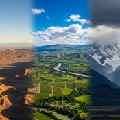
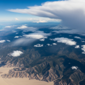
Argentina is a very large country, and because of that, it has many different climate zones. The country goes from 22° to 55° south latitude. This wide span gives Argentina many ways the weather can change. The country’s climate depends on its latitude, how close you are to the ocean, and the big Andes Mountains that stand in the west.

It is important to know about these climate zones before you travel. What you take with you and the best time to go will rely on if you pick the humid north, the calm plains, or the cold parts in the south. In this guide, we talk about how the country’s geography shapes the weather. Then, we will show the main climate zones in the country.

Overview of Argentina’s Geographic Diversity

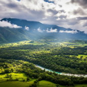
The Andes Mountains stretch along the western side of the country. They are a big reason for the many types of weather you find in Argentina. When you go north of 40° S, the high peaks in the Andes keep the Pacific’s wet air out. This makes the northwest part of the country dry.

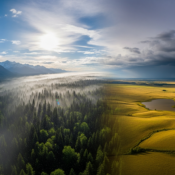
When you move farther south, the Andes Mountains are not as high. This lets wet winds from the west bring rain to a narrow strip over the mountains before the air gets dry over the Patagonian plateau. This makes the green Andean forests look very different from the dry, open steppes.

The weather changes a lot from north to south. In the northeast, some places have thick, green forests. Farther south, there are flat, windy plains, called Patagonia. Even farther down, Tierra del Fuego has a colder, sub-Antarctic feel. The coastal areas along the Atlantic also help control the temperature for the country. This is what makes the weather in the country so different in each place.

Influence of Latitude and Altitude on Weather

Latitude and altitude are two big things that shape weather conditions in the country of Argentina. Because the country stretches far from north to south, latitude matters a lot. The north is closer to the equator. So, people there get warmer, more tropical, or subtropical weather. But when you travel south to the end of the country, it gets much colder, like sub-Antarctic areas.

Altitude is also important. In western Argentina, the Andes Mountains make temperatures drop as you go up from sea level. The average altitude can make weather feel very different even if you are near a lower area. For example, the Puna area in the northwest is at a high altitude and has cool, dry weather, even though it is often warm in other spots in the country.

Because of both latitude and altitude, you can find a wide range of weather conditions in the country just by going up or down in elevation, even if you stay in the same region. That is why you need to think about both when you make plans to travel.

Main Climatic Zones Across the Country

Argentina is mostly split into a few main weather areas. In the north of the country, there are warm climates. Part of this area around the Littoral region has a subtropical climate with rain all year and no dry season. Other northern provinces have a subtropical climate with a clear dry season in the winter.

The middle of Argentina gets a temperate climate. Buenos Aires and other parts nearby have humid and mild weather, with summers that are warm and winters that are cool. Places like Córdoba and San Luis are in the mountains and have an arid temperate climate. There is less rain, and the temperature changes more during the year.

Other parts of Argentina have arid climates or cold climates. Arid climates are found in the Puna and the Patagonian steppe, where rain is rare. Cold climates show up in the Patagonian-Fuegian Andes. These places get rain in the winter and near some peaks, there is snow all year. In the Magellanic and Nival zones, it rains all year and some high parts are covered with permanent snow.

Seasonal Patterns Across Argentina

Argentina gets four clear seasons in the year, but what they feel like can change a lot depending on where you are in the country. During the summer months, there is a lot of heat and humidity, mostly in the north and center of the country. The winter months can be very cold in Patagonia and the Andes, with freezing weather and snow.

The way the weather changes during the year affects more than just people’s plans. It also shapes the annual rainfall, the average temperature, and what people like to do in each part of the country. When you look at summer, autumn, winter, and spring in Argentina, you will see that each part of the country has its own way of feeling every season.

Characteristics of Summer (December to February)

The summer months in Argentina, from December to February, are hot and can be humid, mostly in the north and central parts. Buenos Aires and the Pampas often get high temperatures between 25°C (77°F) and 35°C (95°F). There are summer storms and many sunshine hours.

In the northeast, like Formosa and Misiones, the weather is very hot and humid. There is a lot of heavy rainfall. Temperatures sometimes go up to 40°C (104°F). But it is different in Patagonia. Summer is cooler and drier there. Chubut and Santa Cruz have nice temperatures from 15°C (59°F) to 25°C (77°F). This weather is good for hiking and exploring outside.

Central Argentina has high temperatures in the summer months as well. These weather conditions make the coastal areas a busy spot, and many locals go there for a break. The days are long and the evenings are warm, so people like to be outside at cafes or do other fun activities.

Autumn Climate Variations (March to May)

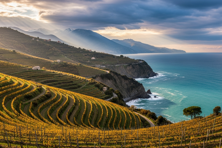
Autumn in Argentina is from March to May. This is the time when the weather changes from hot to cool. The heat of summer goes away, and it gets dry in most parts of the country. You will also see the trees start to change color, especially if you go to wine areas like Mendoza.

In the north of the country, the average temperature drops. The heavy summer rains slow down. Cities like Salta and Tucumán get cooler and drier days. You can see the temperature be between 15°C (59°F) and 25°C (77°F) most days. Buenos Aires and the Pampas also get cooler. This makes it a good time to walk around the city because it is not hot and you do not feel sticky from humidity.

If you go to Patagonia, you will feel the air get colder during autumn. The temperature keeps going down, and you will see strong fall colors in the trees and plants. Much of the country gets less rain now because the annual precipitation slows for a while, but mountain areas could start to see more rain as winter gets close. This season is a good and calm time to visit Patagonia before it gets very cold.

Winter Weather (June to August)

Winter in Argentina, from June to August, brings a big change in the weather. The winter months in the country see low temperatures, especially in the south and west. Cold fronts often move in, and it’s the time for snow in many areas. How cold does it get? In Patagonia, temperatures often go below freezing.

In the Andes Mountains and Patagonia, winter covers the land with snow. Many people come here for skiing and other winter sports. Places like Rio Negro, Neuquén, and Chubut get very cold during this time. The usual temperatures are between -5°C (23°F) and 5°C (41°F). Santa Cruz and Tierra del Fuego can get a lot of snow.

Even in areas with less harsh weather, like Buenos Aires, winter is cool with a lot of moisture in the air. Temperatures in this city are usually between 5°C (41°F) and 15°C (59°F). The northwest part of the country stays cool and dry. For people who do not want the strong cold, this area feels pleasant.

Springtime Conditions (September to November)

Springtime in Argentina lasts from September to November. This time is known for being fresh and nice. The winter cold starts to go away. Temperatures get higher, and the country becomes full of flowers. The weather conditions are mild and feel good for most people. This is why many say it is one of the best times to come and visit.

In the central and northern parts of the country, spring gives you warmer days and more rain after winter was dry. In places like Buenos Aires and Córdoba, temperatures go up to between 20°C and 30°C (68°F to 86°F). You can also see that annual rainfall goes up. The extra water brings life back and helps green plants show up everywhere.

In Patagonia, spring means things are changing. Snow starts to melt there, and the Patagonian winds can be strong. The air is still cool, but days get longer and warmer. This gives people more chances to get outside and have fun. The annual rainfall starts to change, getting the region ready for summer.

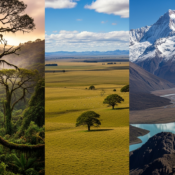
Regional Climates in Argentina

Argentina is a big country, and this leads to many differences in the weather across the land. The north part has the wet Chaco region, and the Andes Mountains have cold, snowy tops. Each place in the country has its own kind of weather. The changes are not just about how hot or cold it gets; they also show in different rain, wind, and how humid it feels.

Knowing about the weather in each place helps us see just how different life can be in the country. Over the next parts, you will find out about how the weather works in Buenos Aires, the special ways that Patagonia stands out, the hot and wet northeast, and the dry, high grounds of the northwest.

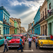
Climate in Buenos Aires and Pampas Region

The weather in Buenos Aires and the nearby Humid Pampas region is known as temperate. This means that you will feel four seasons here. Summers are hot and humid, while winters are cool and damp. The weather conditions here are much like those in Atlanta, a city in the southern U.S.

From December to March, it is summertime in Buenos Aires. During this time, the average temperature is usually between 25°C (77°F) and 35°C (95°F). There are also many thunderstorms in these months. In winter, from June to September, it gets quite cool, with temperatures going down to about 5°C (41°F) and up to 15°C (59°F). Rain falls during all parts of the year, not just in one season.

When you compare Buenos Aires to other places in the country, the climate here is not as harsh. Buenos Aires does not have the very dry weather found in the northwest. It also does not get as cold as southern Patagonia. The Atlantic Ocean is close and helps keep the temperatures from getting too high or too low. This keeps the weather more mild than in other parts of the country.

Patagonia’s Distinctive Weather Patterns

Yes, there are big weather changes from place to place, and Patagonia is a good example of this. The weather in that area is known for being very wild and changing fast. The strong winds there are famous and can be felt all year, but you will notice them most in the open flat lands called the steppes. Make sure you always take a jacket that blocks wind, no matter when you go.

Patagonia is mostly cool and dry. From October to April, the days can be anywhere from about 40 to 65 degrees Fahrenheit (7-18°C). But the wind will sometimes make it feel colder than it is. At night, it usually gets down to the 30s Fahrenheit (0-4°C). In places like Santa Cruz, you will find cold temperatures even in the summer.

The southern part of Patagonia, which includes the Falkland Islands and Tierra del Fuego, has a climate close to what you find near Antarctica. There are cool summers and the winters get very cold. Each day, you can get a mix of sun, rain, and strong winds, so it is a good idea to bring layers that you can put on or take off.

Subtropical Northeast – Misiones & Iguazú

The subtropical northeast of Argentina includes the province of Misiones and the famous Iguazú Falls. The weather in this area is hot, humid, and has high precipitation. It is almost a rainforest, so there is abundant rainfall all year. There is not a real dry season in this region.

Tropical air masses shape the climate in Iguazú. The air is humid, and it gets hot all year. In summer, which is December and January, temperatures will go up into the 80s and 90s Fahrenheit (27-35°C). Rainfall is heaviest in these months. This makes the falls strong and impressive.

In the cooler months like June and July, temperatures are still nice. They usually stay in the 60s and 70s Fahrenheit (15-24°C). The rainfall is not as heavy then, but you still need to watch for rain anytime. The tropical air masses keep the humidity high, and this is always part of life here.

Dry and Mountainous Northwest (Salta, Jujuy, Tucumán)

The northwest part of Argentina is made up of the provinces of Salta, Jujuy, and Tucumán. This area of western Argentina has a dry climate with lots of mountains. For much of the year, there is very little precipitation and not much rain, especially during the dry season in the winter months from June to August.

Altitude really impacts the weather you get here. Lower areas, like Santiago del Estero, are usually hot and very dry. In the higher parts, like in the Puna, it can be much cooler. The Andes mountains are important too. They block rain and keep a lot of the moisture out, making western Argentina even drier. Daily temperatures in this region often go up a lot during the day but drop down fast at night.

Almost all the rainfall—about 80% of it—comes when summer thunderstorms hit between December and March. At other times, the weather is still very dry. This type of climate gives Salta and Jujuy their bright and colorful landscapes that people know and love.

Mendoza and Cuyo Region’s Climate

The Cuyo region has the provinces of Mendoza, San Juan, and La Rioja. This area is known for good wine production. The climate in this region is very dry, and there is a lot of sunshine all year. This makes it nice to visit at any time.

The land is arid to semi-arid. It is best for growing grapes. There is not much rain, so farms use water from snow melted off the Andes. Hot, sunny days and cool nights help grapes ripen well and give them rich flavors.

From December to March, summer in Mendoza is hot and dry. Daytime temperatures are in the 80s Fahrenheit or about 27-32°C. Winters, from June to September, are cool and dry. The provinces of San Juan and San Luis also have this dry, sunny weather. These places can be even hotter and more dry than Mendoza.

Temperature Trends and Averages

Argentina has many types of weather. The average temperature can change a lot from the north to the south. It also can be very different in the low areas and up in the mountains. If you know the temperature trends in the country, you will have a better idea of what to expect on your trip.

One thing to keep in mind is the annual thermal amplitude. This means the gap between the highest and lowest average temperature each year. It can be very different across the country. This is because of things like how close a place is to the ocean or how high up it is. Let’s check out some real temperature data.

Monthly Average Temperatures by Major City

To give you a clearer idea of what to expect, here’s a look at the average temperature ranges for a few major cities across Argentina. Remember that these are averages, and actual temperatures can vary. Buenos Aires and Santa Fe represent the humid temperate climate, while Mendoza shows the dry, continental climate.

City

Summer (Jan) Avg. Temp (C)

Winter (Jul) Avg. Temp (C)

Buenos Aires

25°C – 35°C (77°F – 95°F)

5°C – 15°C (41°F – 59°F)

Mendoza

30°C – 40°C (86°F – 104°F)

0°C – 10°C (32°F – 50°F)

Santa Fe

25°C – 35°C (77°F – 95°F)

5°C – 15°C (41°F – 59°F)

As you can see, Mendoza experiences a much wider temperature range between summer and winter compared to Buenos Aires, which has a more moderate climate due to its coastal location. These temperature patterns also influence the annual rainfall and overall weather experience in each city.

Extreme Highs and Lows

Argentina has a lot of different weather. The country can get very hot or very cold, based on the place and time of year. In the north part, like Santiago del Estero, the summer brings some of the highest temperatures in South America. The temperature can go over 45°C (113°F).

In winter months, places like Patagonia and the Andes get really cold. Sometimes, in Santa Cruz and Tierra del Fuego, it drops to -20°C (-4°F) or even less, mostly in the high mountains. Central Argentina also gets cold. During cold fronts, people in that area can see frost and almost freezing numbers.

These weather conditions happen because the country has lots of different land types. It also gets different air masses. You can find the official numbers about high temperatures and low temperatures in sources like the base de datos mensuales (monthly database). This shows just how much weather in Argentina can change.

Annual Thermal Amplitude and Transitions

The annual thermal amplitude is the gap between the average temperature during the hottest and the coldest months. This change is different in parts of the country and shows how the weather can change in Argentina. Some places in the country have seasons that change smoothly, but in other places, these changes are much stronger.

Central-North Patagonia has very big changes, with the thermal amplitude over 16°C (29°F). This happens there because of tropical air masses in the summer and cold air from the poles in the winter. The center of the country also has large differences between summer and winter temperatures.

But the coastal areas see a smaller swing in average temperature, normally below 10°C (18°F), since the ocean helps keep temperatures from changing too much. The northwest Puna region has an annual amplitude that is also small (less than 9.6°C or 17°F), but that is mainly because it is high up. Even so, the country knows that in the Puna, the gap from day to night can still be very big.

Rainfall and Humidity in Argentina

Rainfall and humidity change a lot across Argentina. There are places with abundant rainfall, like rainforests, and areas that are dry, like deserts. The amount of annual precipitation does not stay the same in all parts. Some parts get plenty of rain, but others stay dry most of the year.

This difference comes from winds and the shape of the land. When you go from east to west, you will see that precipitation decreases a lot. It is good to know about these patterns if you plan to visit, because they shape the land and the things you can do. Now, let’s look at the seasonal rain and how different regions get rain at different times.

Seasonal Rain Patterns and Rainy Season

Yes, there is a rainy season in many parts of the country, but it depends on where you are. The summer months (December to March) are the rainy season in the north and the Cuyo region. During this time, a low-pressure system brings moist air from the Atlantic. This leads to regular thunderstorms.

The subtropical northeast, like Misiones, gets abundant rainfall all year. The downpours are biggest in the summer months. The northern and central parts of the country mostly have their driest season in winter. There is very little precipitation during winter months.

Patagonia has a pattern that is not the same as the rest. The Patagonian Andes get most of their rain and snow in winter months. This happens because fronts come from the Pacific. The Patagonian steppe stays dry all year and gets little precipitation.

Regional Differences in Precipitation

There are big differences in how much rain falls across the country. The northeast gets the highest levels of annual precipitation, especially in Misiones province. This part of Argentina is close to the Atlantic Ocean, and moist winds from there bring rain all year. That is why it has a humid and warm climate.

As you go west, away from the Atlantic Ocean, precipitation decreases a lot. The central Pampas region still gets some rain. This helps it have good soil for growing crops. But, in the western and central part of the country, there is an area that stays very dry which runs from the northwest to the southeast.

This dry area has places like the Puna and Extra-Andean Patagonia. They get less than 200 mm of rain each year. The Andes Mountains block wet winds from the Pacific, creating a rain shadow, so these areas get little rain at all. This big difference between the wet east and dry west is a main part of the country’s climate.

Humidity Levels by Region

Humidity in Argentina changes a lot from place to place. This can make the temperature feel very different in parts of the country. The highest humidity is in the north and east, mostly in the subtropical northeast and coastal areas along the Atlantic Ocean. Buenos Aires and the Pampas have a lot of humidity, especially in the hot summer months.

The high humidity comes from damp winds that blow in from the Atlantic Ocean. When it is summer, a low-atmospheric pressure system called the “Chaco low” pulls warm and moist air in. This makes it sticky and not very comfortable in the north and central parts of the country.

The west and south areas of the country are much drier. The Cuyo region with Mendoza and the Andean northwest have low humidity all year which gives them arid climates. Patagonia is dry too, but coastal areas there get more humidity. Because there is not much humidity, even on hot days, the heat feels easier to handle than in the humid north.

Wind, Atmospheric Circulation, and Weather Extremes

Wind and atmospheric circulation patterns have a big effect on the daily weather and the long-term climate in the country. From the soft winds on the coast to the strong winds that blow in Patagonia, these air movements shape what each place is like. They also bring some of the most well-known and strong weather to Argentina.

In the next parts, we will talk about the main winds and how they change the country. We will also talk about special weather, like the Pampero and Zonda winds. Plus, we will look at problems like floods and droughts that can be caused by nature.

Prevailing Winds and Their Effects

Argentina’s wind patterns are shaped by two main high-pressure areas. One is in the South Atlantic, and the other is in the Pacific Ocean. In the country, north of 40° S latitude, most winds blow from the northeast and east. These come from the South Atlantic high-pressure area. They bring warm and wet air to the north and middle parts of the country.

But things change when you go to Patagonia. There, the wind mostly comes from the west. These westerly winds start from the Pacific Ocean. People know them for being strong and steady. They play a big part in making the weather in Patagonia cool and sometimes tough.

These wind patterns have a big effect on the country’s climate. The wet winds from the Atlantic bring humidity and rain to the northeast. The westerly winds affect the south, sending rain to the Andes mountains while making the Patagonian plateau dry.

Notable Weather Phenomena: Pampero, Zonda, Sudestada

Argentina is a country where you can see many strong and unusual weather events. The Pampero is a cold, dry wind that comes from the south. It moves fast across the Pampas and brings a cold front. This usually happens after a time of high temperatures and a lot of humidity. You might see thunderstorms, a fast drop in temperature, and then the sky becomes clear.

The Zonda is a hot and dry wind. It comes down from the Andes Mountains and mostly hits the Cuyo region, like Mendoza and San Juan. When the Zonda blows, temperatures can get very high in a short time. This wind is full of dust and can feel strong and rough. Sometimes, it causes health problems and damages property.

The Sudestada is a wind that comes from the southeast. It mainly affects the area near the Río de la Plata, including Buenos Aires. This wind brings cold and wet air from the sea. Because of this, there is steady light rain and low temperatures. The Sudestada can even cause floods along the coast because it pushes river water back. These different air masses help make the weather in the country so interesting and memorable.

Natural Disasters: Floods, Droughts, and Tornadoes

Argentina has many kinds of weather, and this makes the country open to natural disasters. Floods often happen here, mostly in the northeastern Littoral region and the Pampas. These places can get a lot of water on the ground after heavy rain for some time. Flash floods can also happen in the mountains when big summer storms hit.

Droughts are also a big worry in the country. The central and western areas sometimes go a long time without any rain. This can really hurt crops, and farming is very important for Argentina’s people and money. When the land stays dry for a long time, huge parts from Chaco to areas in Patagonia can get hit.

Tornadoes are not as common here as in the United States, but there are still tornadoes in Argentina. The “Tornado Corridor” runs through the middle and east part of the country. This is the second most active place for tornadoes in the world. These weather conditions show how wild and hard to guess the weather in Argentina can be.

Travel Tips for Dealing with Argentina’s Climate

Packing for a trip to Argentina can be hard because the weather conditions change a lot. You need to be ready for where you will go and when, so you stay comfortable. If you plan to visit both Iguazú Falls and Patagonia, you will need clothes for two very different types of weather.

These travel tips let you get ready for anything that Argentina’s weather conditions may bring. We talk about what you should pack for each season. We also include how to keep safe if the weather does something you did not expect. We make sure you have help for your trip.

What to Pack for Each Season

Knowing what to pack is very important for a trip to Argentina, because the weather conditions can change a lot. Your packing list will change based on the time of year and where you go in the country. If you are there during the hot summer months, especially in the north or center, make sure to bring light clothes. It is best to have cotton shirts, shorts, and dresses.

In the cold winter months, bringing layers is key, especially if you plan to visit places like Patagonia or the Andes. You will need warm things, like thermal underwear, fleece jackets, and an outer jacket that keeps out rain and wind. In the south, you should also bring a warm hat, gloves, and a scarf.

No matter when you go, it is smart to get ready for many types of weather. Here are some things you will need:

  • Layers: You should pack t-shirts, long-sleeve shirts, and something like a fleece or sweater, because you can use them all year.

  • Wind/Rain Jacket: A jacket that blocks wind and rain is a must for Patagonia and the coastal areas.

  • Comfortable Shoes: You will walk a lot, so have good, sturdy shoes.

  • Sun Protection: Bring a hat, sunglasses, and some sunscreen with a high SPF, because the sun gets strong.

  • Smart Casual Outfit: Pack something nice for your nights out, especially if you visit Buenos Aires.

Preparing for Unpredictable Weather Events

Argentina’s weather can change fast, so it’s good to be ready. This is true in Patagonia, where you might feel all four seasons in one day. You should pack clothes that can be worn in layers. Even when it is sunny, the weather can change quickly. Carry a windproof and waterproof jacket with you.

If you go to the mountains, like the Andes, or anywhere it rains a lot, keep an eye on weather conditions. Check what the weather will be before you go out, especially if you want to hike or drive for a long time. There is a risk of flash floods after a lot of rain. If you see a road is flooded, never try to drive through it.

You should also keep your plans open because of the weather. If it starts raining too much for a hike, you can do something else, like visit a museum or enjoy a nice long lunch. With a good attitude and the right gear, you can still have a good trip, even if the weather is a surprise.

Conclusion

To sum up, Argentina has many kinds of weather, just like it has many types of land. In the northeast, it gets warm and humid during summer. In the northwest, winters can be dry and cool. If you plan to go, it is good to know about these changes in weather. Seasons and different regions affect what you will feel when you travel there. Being ready for the weather and knowing it can change a lot helps you have a better time. This is true whether you want adventure or just want to relax. Make sure you pick the right clothes and stuff for the time of year you visit. This way, you can enjoy your trip in Argentina even more.

Frequently Asked Questions

Are there major differences in weather across Argentina?

Yes, that’s right. Argentina is big, and there is a lot of change in weather from place to place. The country’s size, different climate zones, and the atmospheric circulation patterns all make this happen. In the north, you will find it hot and humid like a subtropical place. But if you go down south to Patagonia, the air is cold, dry, and windy. All these types of weather are part of Argentina.

What months are best for visiting Argentina?

The best time to go will be different depending on where you are. Spring, from September to November, and autumn, from March to May, both have nice weather in most parts of the country. The summer months are great if you want to visit Patagonia. If you want to see Buenos Aires, the shoulder months are a good choice because you can stay away from the hot days and many people.

How reliable are weather forecasts in Argentina?

Weather forecasts in Argentina are good for most big cities and main areas, and they work well for short-term weather conditions. But in places like Patagonia and the Andes, the weather can change fast. It’s smart to check updates often and be ready for sudden changes in weather.

Key Highlights

Before you get ready to go to Brazil, let’s talk about what the weather is like there.

  • Brazil has different climates. In the north it is more tropical, and south of the Tropic of Capricorn it can be cooler.

  • There are five main types of climate in the country: equatorial, semi-arid, highland tropical, and subtropical.

  • Summer happens from December to March. Winter is between June and September.

  • The average temperature drops as you go from the north down to the south.

  • How much rainfall Brazil gets can change a lot. The Amazon and Pantanal have a lot of rain between November and May.

  • The best time to visit depends on which part you want to see. Many people like the months during the change of seasons, because the weather is good and there are not too many other people traveling then.

Introduction

If you are planning a trip to Brazil, it’s good to know about the weather there. The country is huge and has a climate that changes a lot. You will find hot and wet rainforests, but the inland places can be dry. The average temperature, humidity, and air quality are not the same everywhere. In this guide, you will learn about Brazil’s weather. It will help you know what you need to pack and the best time to go.

Overview of Brazil’s Climate Zones

Brazil is a big country. That means the weather in Brazil can change a lot, and it is not the same everywhere. The Tropic of Capricorn cuts through Brazil, making different climate zones in the country. These zones of Brazil change things like average temperature and rainfall. In the north, Brazil is mostly tropical. When you go south from this line, the weather is more mild. There is plenty of sun, and it is not as hot as the north.

This split in the land gives Brazil many kinds of weather. When you travel in Brazil, you might see the hot rain of the Amazon rainforest or enjoy a cooler day at a beach in the south. No matter where you go, Brazil’s weather brings something new. Now, let’s take a look at these tropical and subtropical parts to better know their own weather patterns.

Tropical and Subtropical Regions Explained

Brazil’s weather depends a lot on where it is when you look at the Tropic of Capricorn. The north part of Brazil is in the tropics. This part has a classic tropical climate. You get hot days, lots of sunshine, and high humidity all year. In these places, the average temperature stays high most of the time.

If you go farther south, below the Tropic of Capricorn, the weather changes. Here, the climate is subtropical. These areas are still warm but you can see bigger swings in the weather over the year. The average temperature in the south is not as high as in the north. Winters can feel cooler, more so in the highlands.

Because of this, Brazil has many different kinds of weather. The tropical areas are famous for thick rainforests. These rainforests grow well because of the steady heat and high humidity. The subtropical parts are more mild. Many people like how the weather feels there, and it can be a good place to visit or live in every day.

Unique Regional Weather Patterns in Brazil

Brazil does not just have one type of weather. There are tropical and subtropical areas, but the country is also divided into five main climate types. Each of these has its own way the weather works during the year. Rainfall, humidity, and temperature are not the same everywhere. You can find regions that are equatorial, semi-arid, highland tropical, or subtropical.

Because of this, the dry season and wet season do not start or end at the same time in all parts of Brazil. For people in the Amazon Basin and the Pantanal, most of the rainfall happens from November to May. But if you go to the dry interior area, it will still be hot and dry for most of the year.

The weather is different depending on where you are:

  • Equatorial: This is found in the Amazon. It is hot and humid all the time, and there is a lot of rainfall.

  • Semi-arid: This is found in the middle of Brazil. It is usually hot and dry.

  • Highland Tropical: This climate is seen in the mountains with moderate temperatures.

  • Subtropical: This is in the south. There are seasons and cooler winters.

The way the weather changes from one place to another across Brazil is great for people who want to find either a dry season or more humidity.

Seasonal Changes Throughout the Year

Brazil’s seasons are opposite to the Northern Hemisphere. Summer runs from December through March. It gets hot and humid, especially near the coast. Winter lasts from June to September. Most of the country has mild days, but the south can get cool.

Months like April, May, October, and November often be the most pleasant. The weather feels nice, with mild heat and less rain or storms. These changes in the seasons affect travel and what you can do. It shapes plans for beach trips or seeing Brazil’s natural spots. Here’s how the weather shifts month by month, and what that can mean for your travel.

How Brazilian Weather Varies Month by Month

Understanding the month-to-month weather variations in Brazil can greatly enhance your travel planning. The summer months, from December to March, are typically the hottest and wettest in many parts of the country, with frequent afternoon rainfall. This is especially true in Rio de Janeiro and Salvador.

Conversely, the winter months, from June to September, are drier and cooler. This can be an ideal time to visit many regions, as the lower humidity makes for more comfortable sightseeing. The shoulder months, such as October and November, often strike a perfect balance with warm temperatures and less rainfall, making them a popular time for tourists. Always check local forecasts closer to your travel dates for the most accurate information.

Here’s a general guide to Brazil’s seasons:

Season

Months

General Weather Conditions

Summer

December – March

Hot and humid, especially in coastal areas. This is also the rainy season for many regions.

Autumn

April – June

Temperatures start to cool down. Rainfall decreases in the south and center.

Winter

June – September

Mildest time of year. Cooler temperatures, especially in the south, and generally less rainfall.

Spring

October – November

Temperatures begin to rise. Pleasant weather before the summer heat and rains arrive.

Distinctive Seasons and Their Impact on Travel

The wet and dry seasons in Brazil play a big part in how you enjoy your trip. The dry season, which happens during winter from June to September in most of the popular spots, is the best time to see the sights. You get cooler weather and not much rain. This makes it a good time for walking around the cities or going hiking.

The wet season, on the other hand, falls in the summer months. During this time, there is more rain. You see green views and lively plants, but you might also have your plans changed by heavy rainfall. Big events in Brazil are often set around the weather. For example, Carnival takes place in February. It is summer and it is hot, which makes the party wild and full of high energy.

Keep these things in mind when planning your travel:

  • Dry Season (Winter): This is the best time to see wildlife in the Pantanal and to walk around cities comfortably.

  • Wet Season (Summer): A great time to see huge waterfalls like Iguaçu Falls at their strongest, but the paths may be wet and tricky.

  • Festivals: Many local celebrations, like the June Festivals (Festa Junina), happen during the cooler and drier winter months. These festivals have bonfires and traditional food.

Regional Weather Highlights in Brazil

Yes, Brazil’s weather changes a lot based on where you go. For example, the weather in coastal places like Rio de Janeiro is very different from the cooler air you find in southern cities like Curitiba. Also, the big city of São Paulo has its own kind of weather. This is because of the city’s height above sea level.

This change in weather across areas is important when you plan your trip. The things you pack for a beach trip in the northeast will not be the same as what you take for a work trip to the south. Now, let’s look at what kind of weather you can get in some big cities in Brazil. We will talk about São Paulo, Rio de Janeiro, and Salvador.

Weather Conditions in São Paulo, Rio de Janeiro, and Salvador

The weather can be very different in Brazil’s big cities. In Rio de Janeiro, the climate is like a tropical savannah. Summers are hot, and these go from December to March. Winters will be warmer and feel nice. You will get plenty of sun in Rio. But get ready for rain in the afternoon, mostly from January to April.

São Paulo is south of Rio. The high land here means the weather is not as hot as in Rio. It is still warm, but winters can feel cold. For the latest news, you can get a 10-day weather report for São Paulo on AccuWeather. AccuWeather also gives updates on air quality.

Go further north to Salvador de Bahia and the weather will stay warm all year. The rainfall here is high, and Salvador has a tropical rainforest climate. September is the month where there is less rain. No matter what city you go to, the weather—like rainfall, plenty of sun, and air quality—will make your trip or time there feel special.

Conclusion

To sum up, it is important to know about Brazil’s different weather if you want to visit or explore this lively country. Brazil has many kinds of weather. You will find tropical rains in the Amazon and mild winters in the south. The weather can make a big difference in your trip. If you know about the seasons and what each area is like, you can choose the best time to visit and pick the right things to do. You might want adventure in the green jungles. Or maybe you want to relax on warm beaches. If you understand the weather, you will have a better time. Enjoy all the beauty Brazil has to offer, and let the country’s weather make your visit even more special.

Key Highlights

  • The National Weather Service (NWS) gives people reliable weather information across the United States.

  • Knowing the national weather forecast helps you get ready for things like severe thunderstorms and excessive rainfall.

  • The Weather Prediction Center has maps and forecasts for different times in the day.

  • The US gets many types of weather, like heat in the West and storms in the South.

  • Interactive maps and short-range forecasts help you see changes in weather every day.

  • Keeping up with the forecast is important for planning your day and staying safe.

Introduction

Welcome! Do you ever think about what makes the weather change in the United States? The weather can go from clear skies to a big storm in no time. The good news is, you can use some strong tools to know what is coming. The National Weather Service and the Weather Prediction Center give a forecast, so you can get ready for any weather. This guide shows you how to understand US weather. It will help you learn about national patterns, and what tools you can use to get the most up-to-date forecast for where you live.

Understanding National Weather Patterns in the United States

The United States is a big country with many kinds of weather. You might see snow in the mountains on one day, but at the same time, another place could get caught in a heatwave. The National Weather Service is the main source people trust for the weather forecast. Millions get important updates from them, and these updates help us all know what is coming.

When you know how these weather patterns work, you can get ready for things like excessive rainfall or severe thunderstorms. It matters that you know where to get this weather forecast and other details about bad weather. We will take a look at the different systems that affect weather and what sets each climate across the country apart.

Key Weather Systems That Shape US Conditions

The weather you get each day depends on big weather systems that move across the country. High-pressure and low-pressure systems, plus fronts and troughs, help decide if your day will be sunny or if there will be thunderstorms. People at the National Oceanic and Atmospheric Administration (NOAA) keep a close eye on these weather patterns.

For example, a low-pressure system can bring a lot of rain and even severe thunderstorms to the South. At the same time, a high-pressure system over the West can make the sky clear and bring record heat. The way these systems meet is what gives us the national weather forecast. If you want to check the weather forecast for the US this week, you can look at maps and updates from official sources that track these weather changes.

Some weather systems do much more. There can be excessive rainfall that leads to flooding, or strong conditions that may let tornadoes happen. Watching how these weather systems change and move across the country is so important for a good forecast and for keeping people safe.

Regional Climate Variations Across the Country

The United States isn’t just large; it’s a patchwork of different climates. The weather forecast for the rainy Pacific Northwest will look very different from the dry, hot Southwest. The Midwest experiences a full range of seasons, while the Southeast is known for its humidity and frequent precipitation.

These regional differences are why a single national weather forecast can’t tell the whole story. You can compare today’s weather conditions in different US cities using tools from sources like the NWS and NOAA. There is no endorsement of any specific private service, but these government agencies provide the raw data many platforms use.

Here’s a simple comparison of typical regional weather:

Region

Typical Weather Characteristics

West

Often dry with record heat possible, especially inland.

South

Prone to rain, humidity, and severe storms.

Midwest

Experiences a mix of conditions, from rain to clear skies.

Northeast

Can see scattered showers and variable temperatures.

Exploring US Weather Maps and Forecast Tools

Now that you know about the different kinds of weather, how can you keep track of them? Reliable national weather maps for the United States are easy to find. You can get them from sources like the National Weather Service. These maps give you a simple forecast. They show things like temperature, precipitation, and where severe thunderstorms could happen.

The Weather Prediction Center is focused on these graphic forecasts. It helps you see if there will be severe thunderstorms and lets you know how much rain can fall. If you learn how to use these weather tools, you can become your own weather expert. Next, we will look at interactive maps and where you can get long-term forecasts.

Interactive Weather Maps and Their Uses

Interactive weather maps help you see weather as it happens. These maps do not just give a still image. You get to watch storms build, follow rain as it moves, and check how temperatures change across the country. The National Oceanic and Atmospheric Administration (NOAA) and its Weather Prediction Center give people all of these great tools.

With these maps, you can zoom in on your own spot or look at all of the country. You can put a few types of data on one map, so you get the full picture for the forecast.

Some features you can see on interactive maps are:

  • Radar: Lets you see rain or snow right now, and tells you how strong it is.

  • Temperature: Shows temperatures with colors on different areas.

  • Wind Speed and Direction: Shows how fast wind is blowing and which way it goes.

weather prediction center, national oceanic, atmospheric administration, forecast, noaa, precipitation.

Finding Reliable 7-Day and Short-Range Forecasts

Are you planning your week? You need a good 7-day forecast, and the National Weather Service is the top place to get this. The NWS website has many detailed forecasts for the whole United States. You can look these up by city, state, or zip code. Many news websites and weather apps use data from the NWS and its parent group, NOAA.

The national weather service forecast gives you what to expect each day. If you want to know what is coming soon, short-range forecasts will help. These cover the next 12 to 48 hours. You get more detail about the weather, like pressure and fronts, and how much rain or precipitation you might get.

You can find all this on the NWS website:

  • Medium Range Forecasts: These cover days 3 to 7.

  • Short Range Forecasts: These show the weather for the next 48 hours.

  • Quantitative Precipitation Forecasts: These show how much rain or precipitation you can expect.

Conclusion

In short, knowing the weather in the United States helps you plan your days and keeps you safe. When you spot the main weather trends and see how the climate changes by region, you can use easy forecasting tools to stay up-to-date. Check your local forecast or look at interactive maps. It is smart to have knowledge, so you can deal with the different weather in this country. Be ready for any surprise from Mother Nature. For weather updates that fit where you live, you can sign up for our free alerts.

Frequently Asked Questions

Where can I find up-to-date weather alerts and warnings for the United States?

The best place to get the latest weather alerts and warnings is the National Weather Service (NWS). You can find this at weather.gov. This is the official site of NOAA. The site gives you real-time updates straight from the people who forecast the weather. Another good idea is to turn on Wireless Emergency Alerts (WEA) on your phone. This way, you get a notice right away if there is bad weather.

Keywords: national weather service, nws, noaa

Which websites offer live weather radar and breaking news for US regions?

The National Weather Service (NWS) website has live weather radar for every region in the US. It shows where there is precipitation and when there are severe thunderstorms. The Weather Prediction Center gives detailed maps and more about what is going on.

If you want to know the latest weather forecast or weather news, you can also check your local TV station websites. Trusted national news outlets often give updates about the weather forecast and what to expect.

How can I compare weather conditions across different US cities?

You can compare the weather with other places by going to the National Weather Service (NWS) or NOAA websites. On these sites, you will find a national forecast map. This map lets you see things like temperature, precipitation, and more for many cities at the same time. There are a lot of other weather apps out there, but using these official sites means you get the facts with no commercial endorsement.

Key Highlights

  • Canada has many climate zones, so weather conditions are very different in each part of the country.

  • Each season brings something new, like warm summers that are great for outdoor fun and cold winters with low minimum temperatures.

  • There are many regional changes, with strong winds and a lot of snowfall, especially when winter storms hit.

  • Climate change is still affecting weather patterns, so it is smart to keep up with what is going on.

  • It is important to use a good forecast tool when making plans, because Canada’s weather can change fast.

  • Official sources will give you alerts when there is severe weather.

Introduction

Are you thinking about a trip to Canada, or do you just want to know about the weather there? You are at the right place. Canada is a huge country. The weather changes a lot from place to place and from season to season. On the west coast, you might see mild and rainy winters. In the east, there are cold and snowy days. Knowing the forecast helps you plan for your trip. This guide will share all the main things you need to know about Canada’s weather conditions. It will help you get ready for what the country brings.

Overview of Canada’s Climate

Canada is a large country, so the weather in each part of the country can be very different. For example, if you are in coastal British Columbia, you will have a much milder climate than if you are in the prairies. It is good to check the climate data and know the normal weather conditions in every place before you make any travel plans.

Things like how far north or south a place is, or if it is close to water, change the weather patterns a lot. Climate change is making these patterns shift as well, so it’s important to get the most recent information. Now, let’s see more about the different climate zones in Canada and how the land sets the weather you can expect.

Distinct Climate Zones Across the Country

Yes, the weather in Canada changes a lot depending on where you are. The country has a few main climate zones.

The west coast is known for its temperate climate. The winters here are mild and wet, while the summers are warm and dry. This weather is very different compared to other parts of Canada.

When you go to the interior of Canada, that includes places like the Prairie Provinces. Here, the climate is called continental. The winters are cold and dry, while the summers can be hot and also dry.

If you travel east to southern Canada, you get to places like Ontario and Quebec. This area has a humid climate with warm summers that feel moist and cold winters that have a lot of snow.

In the north, northern Canada, which has the territories, you will find Arctic and subarctic climates. People there get long, very cold winters and short, cool summers.

Because the weather is so different in each part of Canada, you should always check the local forecast for the area you plan to visit.

How Canada’s Latitude Shapes Its Weather

Latitude is a big factor when it comes to Canada’s weather. The country goes from the southern border with the United States all the way to the high Arctic in the far north. This long stretch north to south means the sun hits different parts of the country in different ways.

The parts of the country near the southern border at the 49th parallel get more sunlight. They have four seasons, and the temperatures are warmer through the year. It is easier to travel in this part of the country, but winter can still cause problems.

The far north sees less sunlight. Winters here are long and cold, while summers are short and cool. Weather conditions in the high arctic can be tough and change fast, so travel needs extra planning. Flying and road travel might be affected a lot. Before you go, you should check what latitude your destination is at and plan your trip around it.

Seasonal Weather Patterns in Canada

The weather in Canada changes a lot during the year. The summer months bring warmth and sunshine, and it is a good time for people to visit and spend time outside in most parts of Canada. But even in the summer months, the temperature can change from one area to another.

The winter in Canada is known for being cold and snowy. Winter storms can be tough, especially in the eastern and central parts of Canada. It is good to prepare for the season, no matter if you want to go skiing in the mountains or move around the city. The next sections will show more about how the winter and summer months are different in each part of Canada.

Winter Conditions and Regional Differences

Canada is known for cold winters, but the weather in the country can be very different depending on where you are. The Prairie Provinces, with cities like Winnipeg and Saskatoon, often get colder than other places. The wind chill in these areas can make it feel even colder. There are months when the minimum temperatures drop way below freezing, and it gets very hard to be outside for long.

British Columbia, a place on the coast, does not get as cold. There, winters are much more mild. You will notice more rain in these areas, while heavy snow is not as common. In Central and Eastern Canada, the weather can be a mix. Some winters bring big winter storms, which can bring a lot of snow and ice and make things hard for everyone. These storms can cause all kinds of problems in those parts of Canada.

It is very important to be ready for cold winters, no matter which region you are in. Always look at the wind chill numbers, because they tell you when it feels much colder than what the thermometer says. This can help keep you safe from frostbite during the harshest times.

Summer Weather and Outdoor Activities

The summer months, from June to August, are often the best time to visit many parts of Canada. During these months of the year, you can get warm summers with a lot of sunshine. This is good for outdoor fun like hiking, camping, and spending time in national parks.

Major cities like Toronto, Vancouver, and Montreal are full of life in summer. People enjoy festivals and outdoor food. Even though summers are nice, they can also have heatwaves and days with a lot of humidity. This is true in places like Southern Ontario and Quebec. It’s a good idea to look at the humidex forecast to know how hot it feels for most people.

No matter if you go to the Rocky Mountains or the Atlantic coast, the long and sunny days will give you time to see the beauty of Canada. Be sure to pack for warm weather. At the same time, take clothes for cool evenings, which can happen at higher places or by the water.

Weather Variations by Region

Canada has many different weather patterns, and they change a lot from one place to another. For example, the climate found in coastal British Columbia is quite mild because the Pacific Ocean helps to keep it steady. This is very different from the weather in Central Canada, where it can get much hotter or colder. These changes in the weather shape how people live, the way they work, and lots of other things.

People in different parts of Canada will see different types of hard weather. In the prairies, you might get stuck in a blizzard, while in the Atlantic area, there may be hurricanes. It’s important to know about the weather where you live, so you can get ready and stay safe. Let’s look at what makes the weather special in Eastern and Western Canada.

Eastern Canada (Quebec, Newfoundland, Maritime Provinces)

Eastern Canada’s weather mainly comes from the Atlantic Ocean. The Maritime Provinces, like Prince Edward Island, Nova Scotia, and New Brunswick, get cool and wet weather. There is often fog, and winters are cold with lots of snow. Sometimes this area gets hit by strong storms.

When you go farther north, the weather on the Labrador coast and in Newfoundland gets even tougher. Winters are long and cold here with heavy snowfall. The coast is often covered in fog and strong winds are common. Summers do not last long and are usually cool.

Quebec has different types of weather conditions. Southern Quebec, including Montreal, has hot, humid summers. Winters there are also cold and snowy. If you travel north in the province, the area becomes colder and closer to a subarctic climate. No matter where you are in Quebec, the weather depends on both the place and the time of year.

Western Canada (British Columbia, Alberta, Saskatchewan)

Western Canada is a place of big differences, and this can change how you travel there. On the coast of British Columbia, the weather is the mildest in Canada. There are wet winters and summers that are warm and dry. But once you go over the Rocky Mountains and move into the center, you will see the weather can change fast.

The Prairie provinces, like Alberta and Saskatchewan, are well-known for big swings in the weather. Cities such as Saskatoon can get very cold in winter, sometimes dropping below -30°C. Summer in these places is hot and dry. Southern Alberta gets strong “Chinook” winds that can make winter temperatures go up by many degrees in just a few hours.

Because of these big weather changes, travel in western Canada needs good planning. Winter driving in the Rocky Mountains can be risky when it snows hard and the roads get icy. During summer, the prairies can have storms and even tornadoes. Always check alerts and see what the road and weather conditions are like before you travel.

Average Temperatures Throughout the Year

Knowing the usual temperatures for the months of the year can help you pick clothes and plan your day. Climate data shows climate normals for every month. This gives you a good idea of what temps will be like, but each day can be different from the average. For your daily plans, a reliable forecast is always helpful.

Average temperatures change with the season and where you are in Canada. In January, Vancouver is much warmer than Winnipeg. Let’s look at what to expect with the climate normals in Canada’s winter and summer months.

Typical Winter Temperatures by Region

Winter temperatures in Canada show extreme regional variation, with January often being the coldest month. The minimum temperatures in the prairie city of Winnipeg can regularly fall to -25°C (-13°F) or lower, and that’s before accounting for the dangerous wind chill. The Northwest Territories experience even more profound cold, with averages well below -30°C (-22°F).

In contrast, coastal cities like Vancouver and Victoria have much milder winters, with average January temperatures hovering just above freezing. Central Canada, including Toronto and Ottawa, falls somewhere in between, with average lows around -10°C (14°F), but with frequent cold snaps that bring much lower temperatures.

Here is a look at typical average January low temperatures for a few Canadian cities:

City

Average January Low Temperature (°C)

Average January Low Temperature (°F)

Winnipeg

-21.4

-6.5

Toronto

-10.5

13.1

Vancouver

1.4

34.5

Yellowknife

-29.5

-21.1

Summer Temperature Ranges in Major Cities

Summer brings nice warmth to many big cities in Canada, but there are some clear changes by area. In central Canada, cities like Toronto, Ottawa, and Montreal get warm to hot summers that often feel muggy. The highs in July and August are mainly between the mid-to-high 20s Celsius (70s and 80s Fahrenheit). The air can feel even hotter because of the humidex.

On the west coast, places like Vancouver and Victoria have cooler summer days. High temperatures are usually in the low 20s Celsius (low 70s Fahrenheit), and there is less humidity. This makes the weather feel very good. Many people visit the west coast because the summers there are mild.

If you want the weather forecast for one of these spots, the best idea is to use a good weather app or website. The official WeatherCAN app from Environment and Climate Change Canada gives you live data, 7-day forecasts, and alerts for over 10,000 places in the country. This way, you get the best and latest information right when you need it.

Precipitation, Snowfall, and Frost

Precipitation in Canada can be seen in many ways. This includes light rain and heavy snow. The west coast gets a lot of rain each year. It is more common in autumn and winter. In other parts of the country, people will see most of the precipitation as snow, especially in winter.

Frost also plays a big role for farming and gardening. When it shows up can change by region. While some places in Canada get plenty of sunshine, other areas stay cloudy most of the time. Always pay attention to weather alerts in your area. There are many alerts for heavy rainfall or snow, so check often.

Rainfall and Snow Patterns by Area

Precipitation in Canada changes a lot in different parts of the country. The Pacific coast gets the most rain each year. Most of this comes in the form of rain during the fall and winter. This is what you see in a maritime climate.

The prairie provinces are not as wet. These parts of Canada get moderate rain, usually from storms in the summer. During the long, cold winters, snow is the main way water comes down. The parts around Hudson Bay and in the Arctic also get low precipitation, which is mostly snow.

In eastern Canada, people see a mix. There is a lot of rain in the spring, summer, and fall, and plenty of snow in the winter. Some places in Quebec and the Atlantic provinces get more snow than most other areas. The form of snow people get depends on how cold it is. It can be light and fluffy or wet and heavy.

Frost Dates and Their Impact on Daily Life

Frost dates are the average time when the first frost happens in the fall and the last one in the spring. These dates have a big effect on life in Canada, especially for those in farming and gardening. The start and end of the growing season depend on them, and they tell farmers when to plant and harvest their crops.

The frost dates can also change travel plans for people. The first frost means that nice fall weather is ending and cold days are starting, and this change in the weather can make roads harder to travel. Climate change is making these frost dates move, which brings new problems for farmers and travelers.

Knowing when you might get frost can help you plan.

  • Gardening: If you know the last spring frost date, you can pick a safe time to start planting young plants.

  • Travel: When the first fall frost comes early, the roads can get icy sooner, and this can change your travel path, especially in northern or mountain parts of Canada.

Weather Alerts, Forecasts, and Useful Tools

It is easy to stay up to date about Canada’s changeable weather if you use the right tools. You should get real-time weather updates from official sources because this is very important for your safety and planning. Environment and Climate Change Canada gives you the most trusted weather warnings and alerts across the country.

A good forecast helps you to get ready for anything, like a big heatwave or a snowstorm. You can now see the effects of climate change happening more and more in Canada. This is why it is even more important to use special apps or websites to track the weather. Here are some of the best apps and websites that help you with this.

Trusted Weather Apps and Websites for Real-Time Updates

For real-time updates you can trust, the best pick is always an official source. The Government of Canada’s WeatherCAN app is a smart choice. You get detailed forecasts, radar maps that you can use, and instant alerts for dangerous weather. All these come straight from Environment and Climate Change Canada. The app is made for people in Canada. You can use it on Apple or Android phones.

When you use trusted weather apps like this one, you know you get right information fast. The apps use data from weather stations, satellites, and radar to make their forecasts. The WeatherCAN app will also give you updates on the Air Quality Health Index. This helps you and your family stay safe, especially because climate change is making air quality more important.

Key features to look for in weather apps include:

  • Push Notifications: Get instant alerts in your area if there is a weather warning.

  • Interactive Radar: See rain and snow as it happens, right on your screen.

  • 7-Day Forecasts: Make plans for your week with up-to-date outlooks.

Keep in mind, some apps use your device’s local storage to keep your saved places.

https://weather.gc.ca/warnings/index_e.html

Accessing Official Weather Warnings and Alerts

Staying safe means you need to get official weather warnings. Environment and Climate Change Canada (ECCC) sends out weather alerts. They are the main group in Canada that gives out forecast updates and warnings to the public. These alerts can be called watches, advisories, or warnings. It depends on how bad the weather is and when it may happen. You can find and use these updates right away at the weather.gc.ca site or by using the WeatherCAN app.

These alerts warn people about many dangerous things that come from the weather. This includes rain or heat, frost, and also special alerts about air pollution and air quality due to climate change. The ECCC website has a map you can click on and a list that shows all alerts right now in different parts of Canada. You can use it to see if there are weather alerts in your area or province.

When you use these official sources, you know you are getting the best and most up-to-date alerts. Climate change in Canada can make weather change fast. The forecast and alerts come from experts who use new technology, such as Doppler radar and computer programs. If there is a chance for bad weather to happen, the first thing you should do is check these alerts.

Conclusion

To sum up, knowing about the weather in Canada is good for people who live there and for those who are visiting. The country has many climate zones and there are changes during each season. If you get ready for the weather, you can have a better time. This goes for when you want to try summer fun outside or deal with things in winter. Each part in Canada, from the east to the west, has weather that can change what you do or where you go.

The best way to stay safe is to use trusted weather apps and keep watching for official alerts. This helps you know what’s going on so you can use your time well in this great country. If you want to go for a trip to Canada or if you simply want to know more about the canada climate, feel free to ask for help!

Frequently Asked Questions

Which Canadian cities experience the most extreme weather?

Cities in the prairie provinces and in the north are known for very tough weather. Winnipeg, Saskatoon, Yellowknife, and Iqaluit often have some of the coldest winter days anywhere. There are strong winds that make it feel even colder. These cities can stay very cold for a long time. This is what makes them places with real extreme weather.

What is the best time to visit Canada based on weather conditions?

The best time to go to most of Canada is in the summer months. This is from late June to August. These months have the most sunshine and the warmest weather. It is a good time to get outside and do things. For those going to Southern Ontario or Ontario, this is a great time too. Just know that there might be some humidity.

How does the climate affect travel plans within Canada?

Canada’s weather can affect travel plans a lot. You will see winter storms most from December to March. These can cause flights to be canceled and make roads unsafe. The time of the year also matters because things like wildfires can make air pollution bad. This could change or stop what you want to do. Always check weather conditions before you go anywhere in Canada.